
Easier access to scientific data

Brought to you by NOAA CoastWatch Great Lakes Node
|
ERDDAP
Easier access to scientific data |
|
Brought to you by NOAA CoastWatch Great Lakes Node |
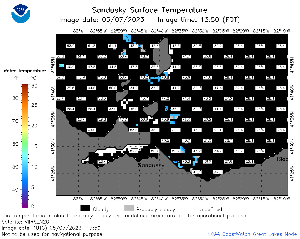
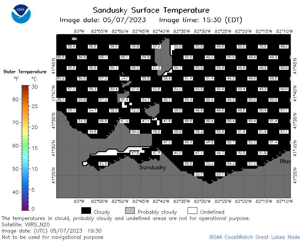
| Dataset Title: | Lake Erie Sandusky Surface Temperature Contour Map (2022-present)


|
| Institution: | CoastWatch Great Lakes Node (Dataset ID: LE_NRT_TC_e12) |
| Information: | Summary
| License
| Metadata
| Background | Subset
| Data Access Form
| Make a graph
| Subset
| Data Access Form
| Make a graph
|
![[ICO]](https://apps.glerl.noaa.gov/erddap/images/fileIcons/blank.gif) | Name | Last modified | Size | Description |
|---|---|---|---|---|
![[DIR]](https://apps.glerl.noaa.gov/erddap/images/fileIcons/back.gif) | Parent Directory | - | - | |
![[IMG]](https://apps.glerl.noaa.gov/erddap/images/fileIcons/image2.gif)  | e12_2023_05_07_0120.png | 07-May-2023 05:37 | 20632 | |
 | e12_2023_05_07_0210.png | 07-May-2023 05:44 | 26475 | |
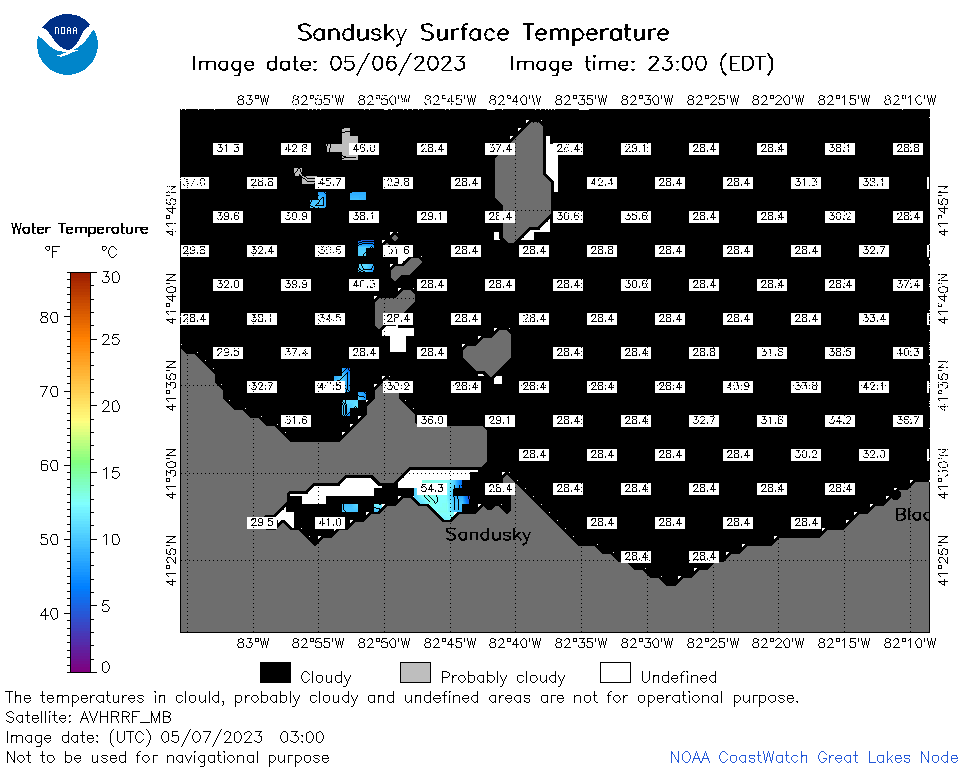 | e12_2023_05_07_0300.png | 07-May-2023 05:51 | 24316 | |
 | e12_2023_05_07_0620.png | 07-May-2023 09:31 | 21412 | |
 | e12_2023_05_07_0710.png | 07-May-2023 10:32 | 28683 | |
 | e12_2023_05_07_0800.png | 07-May-2023 09:37 | 23031 | |
 | e12_2023_05_07_1430.png | 07-May-2023 18:41 | 20579 | |
 | e12_2023_05_07_1520.png | 07-May-2023 18:53 | 20666 | |
 | e12_2023_05_07_1610.png | 07-May-2023 20:40 | 20647 | |
 | e12_2023_05_07_1750.png | 07-May-2023 21:08 | 25131 | |
 | e12_2023_05_07_1840.png | 07-May-2023 21:15 | 23160 | |
 | e12_2023_05_07_1930.png | 07-May-2023 21:34 | 22752 | |
 | e12_2023_127.png | 08-May-2023 10:08 | 28086 | |