
Easier access to scientific data

Brought to you by NOAA CoastWatch Great Lakes Node
|
ERDDAP
Easier access to scientific data |
|
Brought to you by NOAA CoastWatch Great Lakes Node |
| Dataset Title: | Lake Erie Sandusky Surface Temperature Contour Map (2022-present)


|
| Institution: | CoastWatch Great Lakes Node (Dataset ID: LE_NRT_TC_e12) |
| Information: | Summary
| License
| Metadata
| Background | Subset
| Data Access Form
| Make a graph
| Subset
| Data Access Form
| Make a graph
|
![[ICO]](https://apps.glerl.noaa.gov/erddap/images/fileIcons/blank.gif) | Name | Last modified | Size | Description |
|---|---|---|---|---|
![[DIR]](https://apps.glerl.noaa.gov/erddap/images/fileIcons/back.gif) | Parent Directory | - | - | |
![[IMG]](https://apps.glerl.noaa.gov/erddap/images/fileIcons/image2.gif) 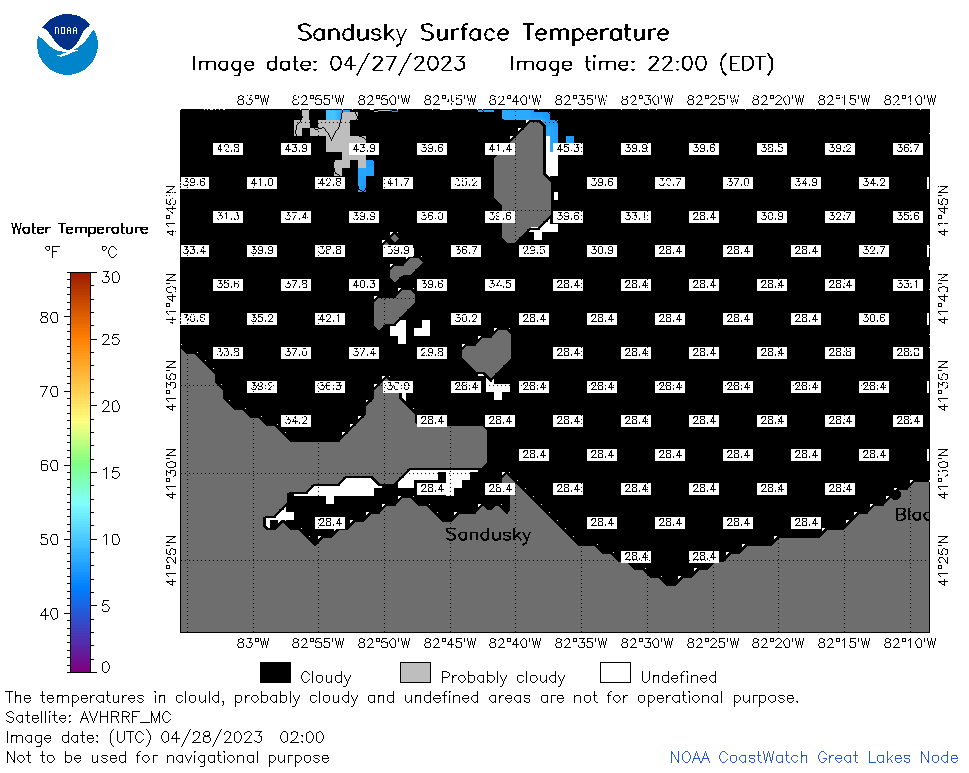 | e12_2023_04_28_0200.png | 28-Apr-2023 05:51 | 23016 | |
 | e12_2023_04_28_0240.png | 28-Apr-2023 05:57 | 29214 | |
 | e12_2023_04_28_0640.png | 28-Apr-2023 18:42 | 20674 | |
 | e12_2023_04_28_0730.png | 28-Apr-2023 18:48 | 20651 | |
 | e12_2023_04_28_0820.png | 28-Apr-2023 18:55 | 20746 | |
 | e12_2023_04_28_1500.png | 28-Apr-2023 19:10 | 20781 | |
 | e12_2023_04_28_1550.png | 28-Apr-2023 19:16 | 20676 | |
 | e12_2023_04_28_1710.png | 28-Apr-2023 19:34 | 20877 | |
 | e12_2023_04_28_1810.png | 28-Apr-2023 21:34 | 23234 | |
 | e12_2023_04_28_1850.png | 28-Apr-2023 20:38 | 22533 | |