
Easier access to scientific data

Brought to you by NOAA CoastWatch Great Lakes Node
|
ERDDAP
Easier access to scientific data |
|
Brought to you by NOAA CoastWatch Great Lakes Node |
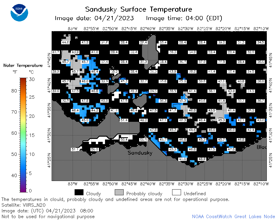
| Dataset Title: | Lake Erie Sandusky Surface Temperature Contour Map (2022-present)


|
| Institution: | CoastWatch Great Lakes Node (Dataset ID: LE_NRT_TC_e12) |
| Information: | Summary
| License
| Metadata
| Background | Subset
| Data Access Form
| Make a graph
| Subset
| Data Access Form
| Make a graph
|
![[ICO]](https://apps.glerl.noaa.gov/erddap/images/fileIcons/blank.gif) | Name | Last modified | Size | Description |
|---|---|---|---|---|
![[DIR]](https://apps.glerl.noaa.gov/erddap/images/fileIcons/back.gif) | Parent Directory | - | - | |
![[IMG]](https://apps.glerl.noaa.gov/erddap/images/fileIcons/image2.gif)  | e12_2023_04_21_0150.png | 21-Apr-2023 05:41 | 27144 | |
 | e12_2023_04_21_0240.png | 21-Apr-2023 05:48 | 26244 | |
 | e12_2023_04_21_0330.png | 21-Apr-2023 05:55 | 20561 | |
 | e12_2023_04_21_0620.png | 21-Apr-2023 09:31 | 23850 | |
 | e12_2023_04_21_0710.png | 21-Apr-2023 11:34 | 26839 | |
 | e12_2023_04_21_0800.png | 21-Apr-2023 11:41 | 30402 | |
 | e12_2023_04_21_1500.png | 21-Apr-2023 18:34 | 20578 | |
 | e12_2023_04_21_1550.png | 21-Apr-2023 17:48 | 20666 | |
 | e12_2023_04_21_1640.png | 21-Apr-2023 19:32 | 20098 | |
 | e12_2023_04_21_1750.png | 21-Apr-2023 19:48 | 20729 | |
 | e12_2023_04_21_1840.png | 21-Apr-2023 22:42 | 21786 | |
 | e12_2023_04_21_1930.png | 21-Apr-2023 22:49 | 20628 | |
 | e12_2023_111.png | 22-Apr-2023 10:09 | 30768 | |