
Easier access to scientific data

Brought to you by NOAA CoastWatch Great Lakes Node
|
ERDDAP
Easier access to scientific data |
|
Brought to you by NOAA CoastWatch Great Lakes Node |
| Dataset Title: | Lake Erie Western Region Surface Temperature Contour Map (2022-present)


|
| Institution: | CoastWatch Great Lakes Node (Dataset ID: LE_NRT_TC_e1) |
| Information: | Summary
| License
| Metadata
| Background | Subset
| Data Access Form
| Make a graph
| Subset
| Data Access Form
| Make a graph
|
![[ICO]](https://apps.glerl.noaa.gov/erddap/images/fileIcons/blank.gif) | Name | Last modified | Size | Description |
|---|---|---|---|---|
![[DIR]](https://apps.glerl.noaa.gov/erddap/images/fileIcons/back.gif) | Parent Directory | - | - | |
![[IMG]](https://apps.glerl.noaa.gov/erddap/images/fileIcons/image2.gif)  | e1_2024_10_02_0610.png | 02-Oct-2024 23:30 | 24762 | |
 | e1_2024_10_02_0630.png | 02-Oct-2024 23:31 | 29894 | |
 | e1_2024_10_02_0650.png | 02-Oct-2024 23:32 | 19488 | |
 | e1_2024_10_02_0700.png | 02-Oct-2024 23:33 | 30445 | |
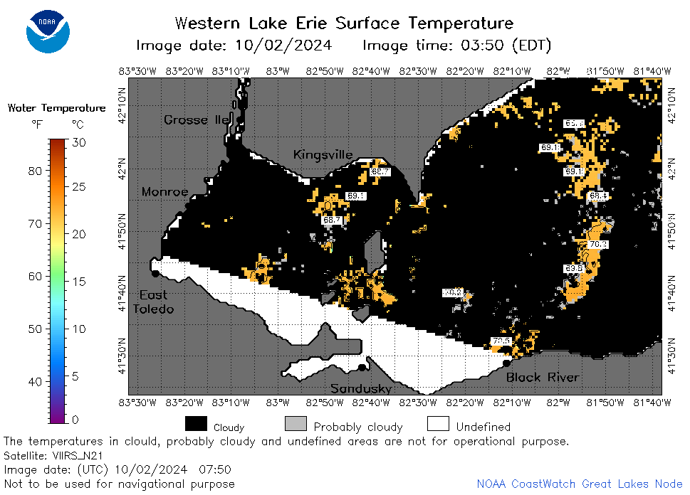 | e1_2024_10_02_0750.png | 02-Oct-2024 23:34 | 30166 | |
 | e1_2024_10_02_0810.png | 02-Oct-2024 23:35 | 22398 | |
 | e1_2024_10_02_0840.png | 02-Oct-2024 23:36 | 21747 | |
 | e1_2024_10_02_0930.png | 02-Oct-2024 23:37 | 19483 | |
 | e1_2024_10_02_0950.png | 03-Oct-2024 00:30 | 19471 | |
 | e1_2024_10_02_1640.png | 03-Oct-2024 00:31 | 20287 | |
 | e1_2024_10_02_1730.png | 03-Oct-2024 00:32 | 35987 | |
 | e1_2024_10_02_1740.png | 03-Oct-2024 01:30 | 19465 | |
 | e1_2024_10_02_1800.png | 03-Oct-2024 00:33 | 36731 | |
 | e1_2024_10_02_1820.png | 03-Oct-2024 00:34 | 36032 | |
 | e1_2024_10_02_1910.png | 03-Oct-2024 00:35 | 35324 | |
 | e1_2024_10_02_1920.png | 03-Oct-2024 00:36 | 19459 | |
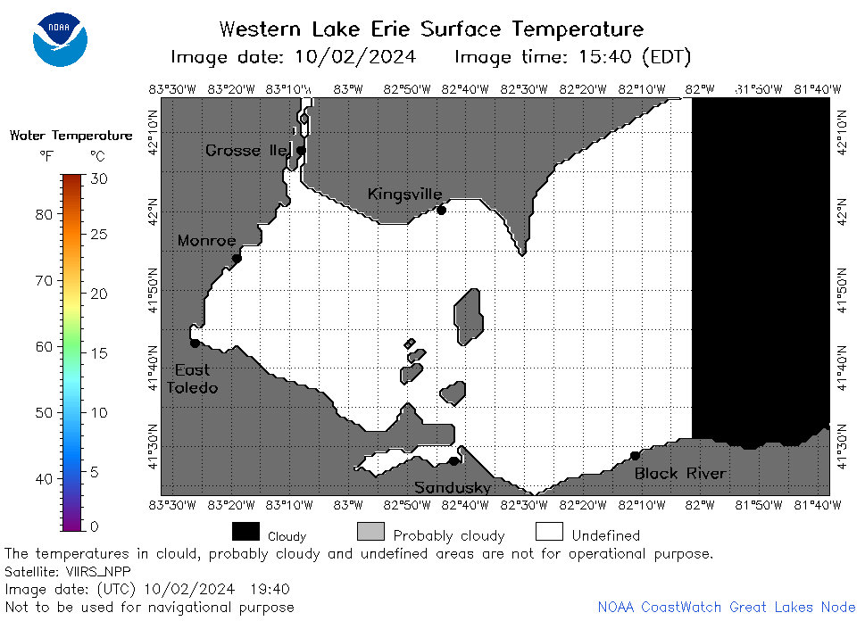 | e1_2024_10_02_1940.png | 03-Oct-2024 00:37 | 22227 | |
 | e1_2024_10_02_2000.png | 03-Oct-2024 00:37 | 19466 | |
 | e1_2024_276.png | 03-Oct-2024 09:11 | 29713 | |