
Easier access to scientific data

Brought to you by NOAA CoastWatch Great Lakes Node
|
ERDDAP
Easier access to scientific data |
|
Brought to you by NOAA CoastWatch Great Lakes Node |
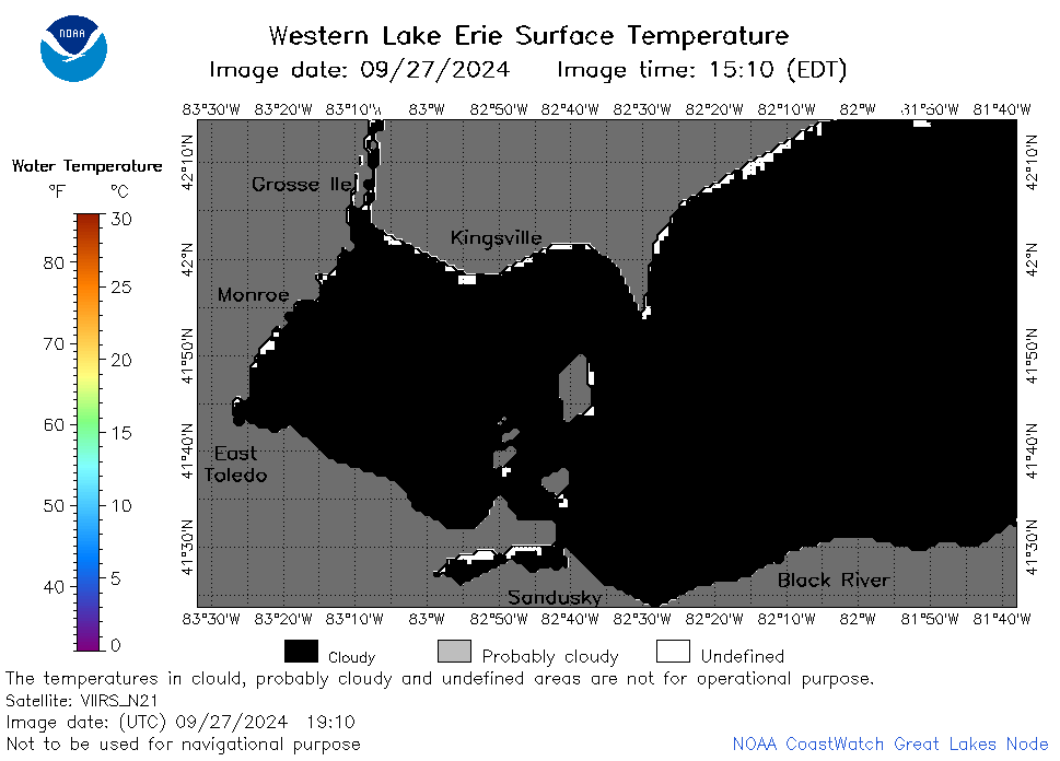
| Dataset Title: | Lake Erie Western Region Surface Temperature Contour Map (2022-present)


|
| Institution: | CoastWatch Great Lakes Node (Dataset ID: LE_NRT_TC_e1) |
| Information: | Summary
| License
| Metadata
| Background | Subset
| Data Access Form
| Make a graph
| Subset
| Data Access Form
| Make a graph
|
![[ICO]](https://apps.glerl.noaa.gov/erddap/images/fileIcons/blank.gif) | Name | Last modified | Size | Description |
|---|---|---|---|---|
![[DIR]](https://apps.glerl.noaa.gov/erddap/images/fileIcons/back.gif) | Parent Directory | - | - | |
![[IMG]](https://apps.glerl.noaa.gov/erddap/images/fileIcons/image2.gif)  | e1_2024_09_27_0600.png | 27-Sep-2024 10:30 | 20321 | |
 | e1_2024_09_27_0630.png | 27-Sep-2024 12:30 | 20367 | |
 | e1_2024_09_27_0650.png | 27-Sep-2024 13:30 | 20433 | |
 | e1_2024_09_27_0740.png | 27-Sep-2024 13:31 | 20579 | |
 | e1_2024_09_27_0810.png | 27-Sep-2024 13:32 | 20479 | |
 | e1_2024_09_27_0830.png | 27-Sep-2024 16:30 | 20468 | |
 | e1_2024_09_27_0920.png | 27-Sep-2024 13:33 | 19498 | |
 | e1_2024_09_27_0950.png | 27-Sep-2024 16:31 | 19495 | |
 | e1_2024_09_27_1630.png | 27-Sep-2024 21:30 | 20334 | |
 | e1_2024_09_27_1810.png | 27-Sep-2024 21:31 | 20387 | |
 | e1_2024_09_27_1910.png | 27-Sep-2024 22:30 | 20331 | |
 | e1_2024_09_27_1930.png | 27-Sep-2024 22:31 | 20907 | |
 | e1_2024_09_27_1950.png | 27-Sep-2024 22:32 | 19492 | |
 | e1_2024_09_27_2000.png | 27-Sep-2024 23:30 | 19516 | |
 | e1_2024_271.png | 28-Sep-2024 09:11 | 25953 | |