
Easier access to scientific data

Brought to you by NOAA CoastWatch Great Lakes Node
|
ERDDAP
Easier access to scientific data |
|
Brought to you by NOAA CoastWatch Great Lakes Node |
| Dataset Title: | Lake Erie Western Region Surface Temperature Contour Map (2022-present)


|
| Institution: | CoastWatch Great Lakes Node (Dataset ID: LE_NRT_TC_e1) |
| Information: | Summary
| License
| Metadata
| Background | Subset
| Data Access Form
| Make a graph
| Subset
| Data Access Form
| Make a graph
|
![[ICO]](https://apps.glerl.noaa.gov/erddap/images/fileIcons/blank.gif) | Name | Last modified | Size | Description |
|---|---|---|---|---|
![[DIR]](https://apps.glerl.noaa.gov/erddap/images/fileIcons/back.gif) | Parent Directory | - | - | |
![[IMG]](https://apps.glerl.noaa.gov/erddap/images/fileIcons/image2.gif)  | e1_2024_09_20_0130.png | 20-Sep-2024 20:30 | 37892 | |
 | e1_2024_09_20_0220.png | 20-Sep-2024 21:30 | 34386 | |
 | e1_2024_09_20_0230.png | 20-Sep-2024 21:31 | 26397 | |
 | e1_2024_09_20_0410.png | 20-Sep-2024 16:30 | 19508 | |
 | e1_2024_09_20_0810.png | 21-Sep-2024 01:30 | 47126 | |
 | e1_2024_09_20_0900.png | 21-Sep-2024 01:31 | 19476 | |
 | e1_2024_09_20_1350.png | 21-Sep-2024 00:30 | 20308 | |
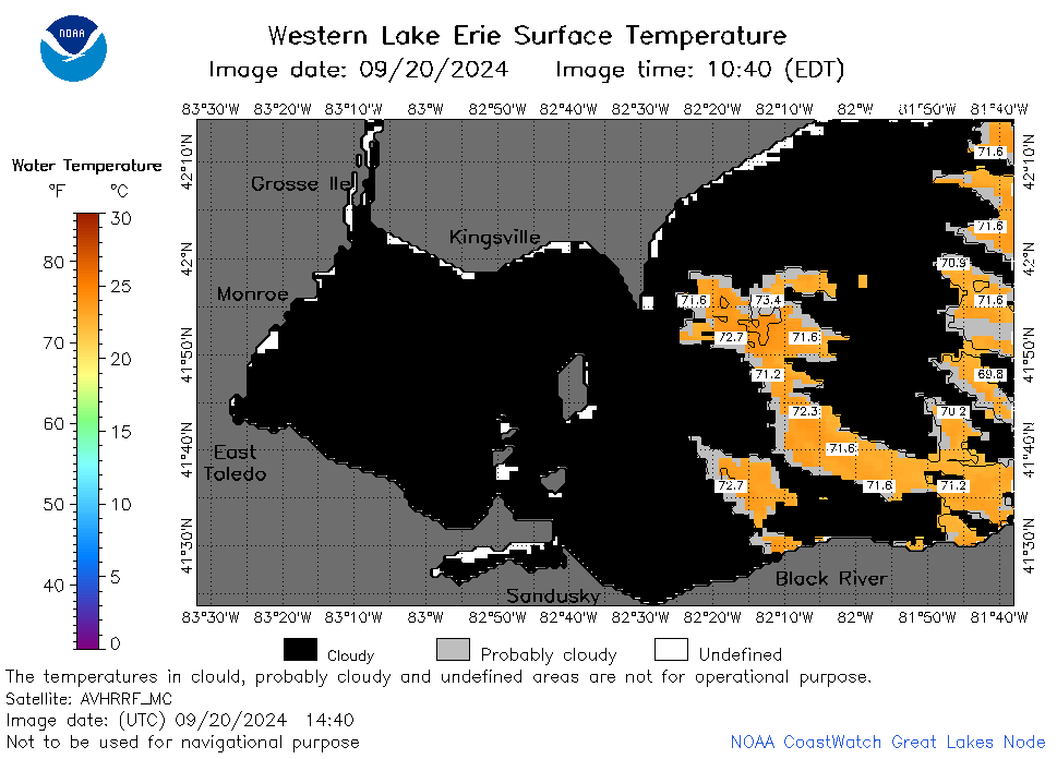 | e1_2024_09_20_1440.png | 21-Sep-2024 01:32 | 27860 | |
 | e1_2024_09_20_1530.png | 21-Sep-2024 01:33 | 21312 | |
 | e1_2024_09_20_1620.png | 21-Sep-2024 02:30 | 23868 | |
 | e1_2024_09_20_1710.png | 21-Sep-2024 03:30 | 19484 | |
 | e1_2024_264.png | 21-Sep-2024 09:11 | 25820 | |