
Easier access to scientific data

Brought to you by NOAA CoastWatch Great Lakes Node
|
ERDDAP
Easier access to scientific data |
|
Brought to you by NOAA CoastWatch Great Lakes Node |
| Dataset Title: | Lake Erie Western Region Surface Temperature Contour Map (2022-present)


|
| Institution: | CoastWatch Great Lakes Node (Dataset ID: LE_NRT_TC_e1) |
| Information: | Summary
| License
| Metadata
| Background | Subset
| Data Access Form
| Make a graph
| Subset
| Data Access Form
| Make a graph
|
![[ICO]](https://apps.glerl.noaa.gov/erddap/images/fileIcons/blank.gif) | Name | Last modified | Size | Description |
|---|---|---|---|---|
![[DIR]](https://apps.glerl.noaa.gov/erddap/images/fileIcons/back.gif) | Parent Directory | - | - | |
![[IMG]](https://apps.glerl.noaa.gov/erddap/images/fileIcons/image2.gif)  | e1_2024_06_20_0700.png | 20-Jun-2024 16:24 | 49295 | |
 | e1_2024_06_20_0720.png | 20-Jun-2024 18:24 | 49023 | |
 | e1_2024_06_20_0750.png | 20-Jun-2024 22:24 | 47893 | |
 | e1_2024_06_20_0840.png | 20-Jun-2024 16:25 | 28670 | |
 | e1_2024_06_20_0930.png | 20-Jun-2024 22:25 | 19473 | |
 | e1_2024_06_20_1820.png | 20-Jun-2024 21:24 | 45465 | |
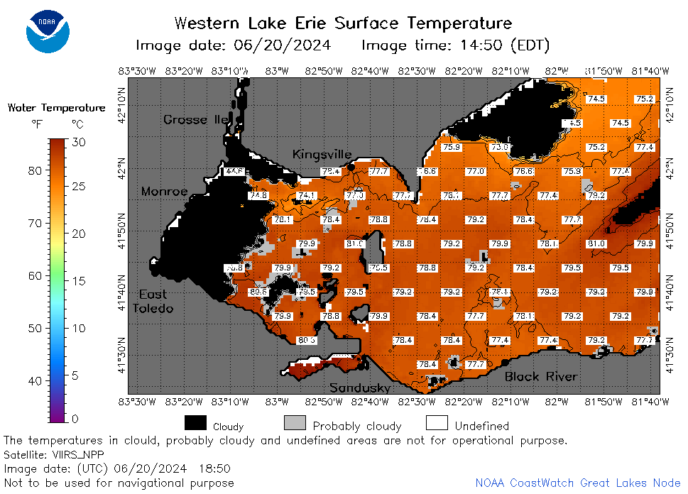 | e1_2024_06_20_1850.png | 20-Jun-2024 22:26 | 44019 | |
 | e1_2024_172.png | 21-Jun-2024 09:14 | 36988 | |