
Easier access to scientific data

Brought to you by NOAA CoastWatch Great Lakes Node
|
ERDDAP
Easier access to scientific data |
|
Brought to you by NOAA CoastWatch Great Lakes Node |
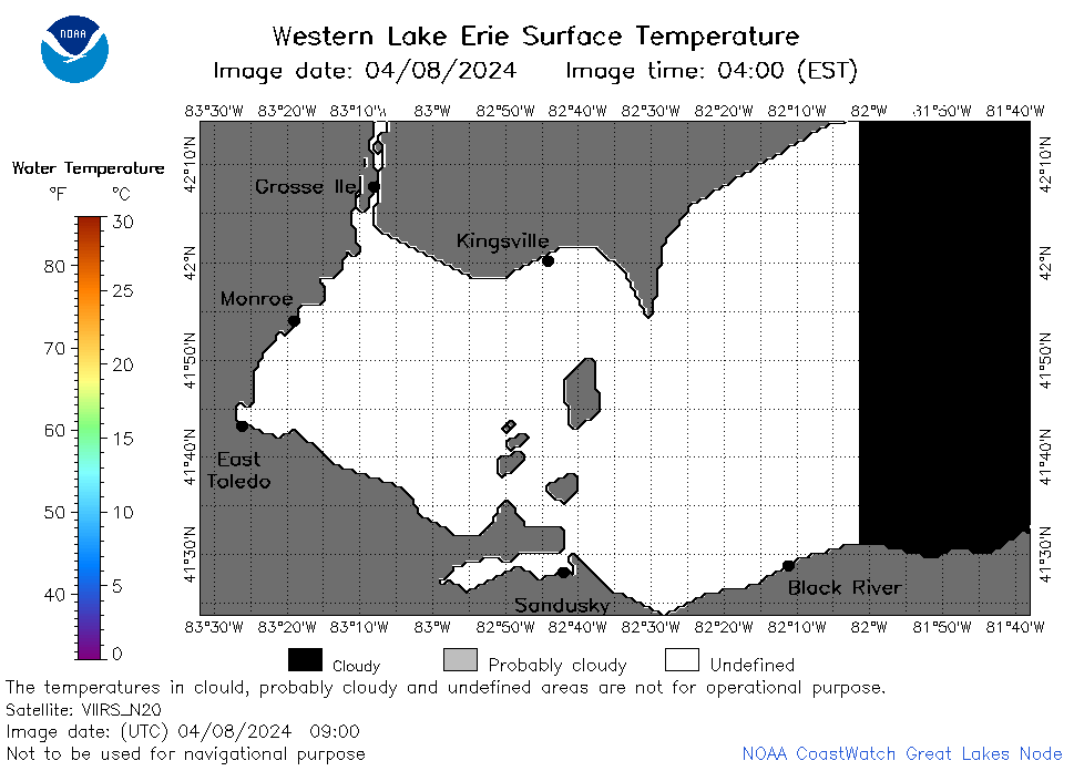
| Dataset Title: | Lake Erie Western Region Surface Temperature Contour Map (2022-present)


|
| Institution: | CoastWatch Great Lakes Node (Dataset ID: LE_NRT_TC_e1) |
| Information: | Summary
| License
| Metadata
| Background | Subset
| Data Access Form
| Make a graph
| Subset
| Data Access Form
| Make a graph
|
![[ICO]](https://apps.glerl.noaa.gov/erddap/images/fileIcons/blank.gif) | Name | Last modified | Size | Description |
|---|---|---|---|---|
![[DIR]](https://apps.glerl.noaa.gov/erddap/images/fileIcons/back.gif) | Parent Directory | - | - | |
![[IMG]](https://apps.glerl.noaa.gov/erddap/images/fileIcons/image2.gif)  | e1_2024_04_08_0100.png | 08-Apr-2024 06:24 | 20334 | |
 | e1_2024_04_08_0140.png | 08-Apr-2024 06:25 | 21229 | |
 | e1_2024_04_08_0150.png | 08-Apr-2024 06:26 | 21683 | |
 | e1_2024_04_08_0240.png | 08-Apr-2024 06:27 | 20967 | |
 | e1_2024_04_08_0330.png | 08-Apr-2024 06:28 | 21492 | |
 | e1_2024_04_08_0650.png | 08-Apr-2024 13:24 | 20730 | |
 | e1_2024_04_08_0720.png | 08-Apr-2024 10:24 | 20630 | |
 | e1_2024_04_08_0830.png | 08-Apr-2024 13:25 | 20795 | |
 | e1_2024_04_08_0900.png | 08-Apr-2024 13:26 | 22259 | |
 | e1_2024_04_08_1400.png | 08-Apr-2024 18:24 | 20315 | |
 | e1_2024_04_08_1450.png | 08-Apr-2024 18:25 | 21252 | |
 | e1_2024_04_08_1540.png | 08-Apr-2024 19:24 | 21437 | |
 | e1_2024_04_08_1630.png | 08-Apr-2024 20:24 | 20826 | |
 | e1_2024_04_08_1700.png | 08-Apr-2024 19:25 | 28039 | |
 | e1_2024_04_08_1720.png | 08-Apr-2024 20:25 | 19488 | |
 | e1_2024_04_08_1820.png | 08-Apr-2024 22:24 | 20654 | |
 | e1_2024_04_08_1840.png | 08-Apr-2024 22:25 | 20669 | |
 | e1_2024_099.png | 09-Apr-2024 11:11 | 29904 | |