
Easier access to scientific data

Brought to you by NOAA CoastWatch Great Lakes Node
|
ERDDAP
Easier access to scientific data |
|
Brought to you by NOAA CoastWatch Great Lakes Node |
| Dataset Title: | Lake Erie Western Region Surface Temperature Contour Map (2022-present)


|
| Institution: | CoastWatch Great Lakes Node (Dataset ID: LE_NRT_TC_e1) |
| Information: | Summary
| License
| Metadata
| Background | Subset
| Data Access Form
| Make a graph
| Subset
| Data Access Form
| Make a graph
|
![[ICO]](https://apps.glerl.noaa.gov/erddap/images/fileIcons/blank.gif) | Name | Last modified | Size | Description |
|---|---|---|---|---|
![[DIR]](https://apps.glerl.noaa.gov/erddap/images/fileIcons/back.gif) | Parent Directory | - | - | |
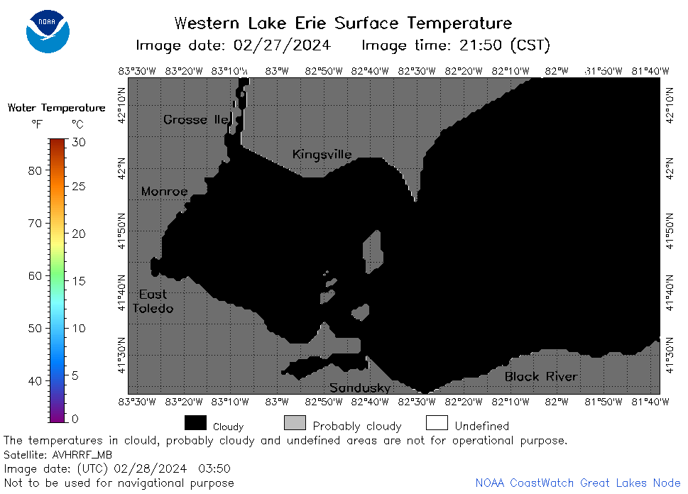
![[IMG]](https://apps.glerl.noaa.gov/erddap/images/fileIcons/image2.gif)  | e1_2024_02_28_0120.png | 28-Feb-2024 21:24 | 21531 | |
 | e1_2024_02_28_0130.png | 28-Feb-2024 21:25 | 23086 | |
 | e1_2024_02_28_0210.png | 28-Feb-2024 21:26 | 25935 | |
 | e1_2024_02_28_0220.png | 28-Feb-2024 21:27 | 19487 | |
 | e1_2024_02_28_0300.png | 28-Feb-2024 21:28 | 21725 | |
 | e1_2024_02_28_0310.png | 28-Feb-2024 21:29 | 22704 | |
 | e1_2024_02_28_0350.png | 28-Feb-2024 21:30 | 19528 | |
 | e1_2024_02_28_0600.png | 28-Feb-2024 21:30 | 20326 | |
 | e1_2024_02_28_0650.png | 28-Feb-2024 21:31 | 26033 | |
 | e1_2024_02_28_0740.png | 28-Feb-2024 21:32 | 27934 | |
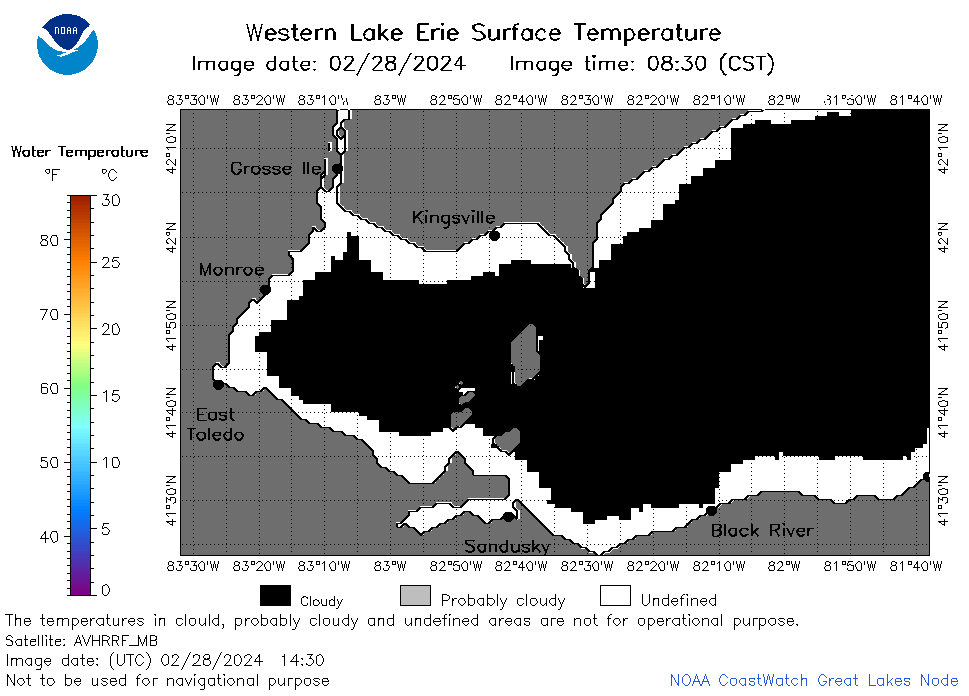
 | e1_2024_02_28_0830.png | 28-Feb-2024 21:33 | 24372 | |
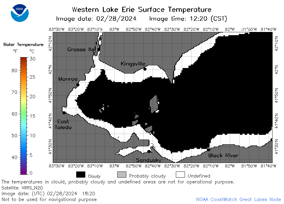
 | e1_2024_02_28_0920.png | 28-Feb-2024 22:24 | 19496 | |
 | e1_2024_02_28_1430.png | 28-Feb-2024 21:34 | 22035 | |
 | e1_2024_02_28_1610.png | 28-Feb-2024 21:35 | 22262 | |
 | e1_2024_02_28_1700.png | 28-Feb-2024 21:36 | 19481 | |
 | e1_2024_02_28_1730.png | 28-Feb-2024 22:25 | 22098 | |
 | e1_2024_02_28_1820.png | 28-Feb-2024 21:36 | 22181 | |
 | e1_2024_02_28_1910.png | 28-Feb-2024 23:24 | 21980 | |
 | e1_2024_059.png | 29-Feb-2024 11:11 | 34716 | |