
Easier access to scientific data

Brought to you by NOAA CoastWatch Great Lakes Node
|
ERDDAP
Easier access to scientific data |
|
Brought to you by NOAA CoastWatch Great Lakes Node |
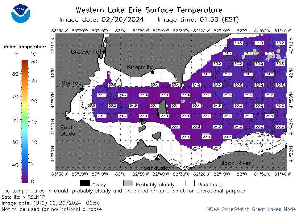
| Dataset Title: | Lake Erie Western Region Surface Temperature Contour Map (2022-present)


|
| Institution: | CoastWatch Great Lakes Node (Dataset ID: LE_NRT_TC_e1) |
| Information: | Summary
| License
| Metadata
| Background | Subset
| Data Access Form
| Make a graph
| Subset
| Data Access Form
| Make a graph
|
![[ICO]](https://apps.glerl.noaa.gov/erddap/images/fileIcons/blank.gif) | Name | Last modified | Size | Description |
|---|---|---|---|---|
![[DIR]](https://apps.glerl.noaa.gov/erddap/images/fileIcons/back.gif) | Parent Directory | - | - | |
![[IMG]](https://apps.glerl.noaa.gov/erddap/images/fileIcons/image2.gif)  | e1_2024_02_20_0140.png | 20-Feb-2024 06:26 | 56239 | |
 | e1_2024_02_20_0230.png | 20-Feb-2024 06:28 | 53820 | |
 | e1_2024_02_20_0320.png | 20-Feb-2024 06:30 | 40280 | |
 | e1_2024_02_20_0600.png | 20-Feb-2024 09:26 | 20293 | |
 | e1_2024_02_20_0650.png | 20-Feb-2024 11:26 | 40328 | |
 | e1_2024_02_20_0740.png | 20-Feb-2024 11:28 | 37932 | |
 | e1_2024_02_20_0830.png | 20-Feb-2024 12:26 | 42429 | |
 | e1_2024_02_20_0920.png | 20-Feb-2024 12:28 | 19476 | |
 | e1_2024_02_20_1440.png | 20-Feb-2024 18:26 | 19458 | |
 | e1_2024_02_20_1450.png | 20-Feb-2024 18:28 | 33284 | |
 | e1_2024_02_20_1530.png | 20-Feb-2024 19:26 | 27709 | |
 | e1_2024_02_20_1540.png | 20-Feb-2024 19:28 | 27946 | |
 | e1_2024_02_20_1620.png | 20-Feb-2024 20:26 | 19458 | |
 | e1_2024_02_20_1630.png | 20-Feb-2024 20:28 | 34399 | |
 | e1_2024_02_20_1710.png | 20-Feb-2024 20:30 | 19456 | |
 | e1_2024_02_20_1730.png | 20-Feb-2024 22:26 | 35772 | |
 | e1_2024_02_20_1820.png | 21-Feb-2024 00:26 | 33058 | |
 | e1_2024_02_20_1910.png | 21-Feb-2024 00:28 | 33836 | |
 | e1_2024_051.png | 21-Feb-2024 10:15 | 31379 | |