
Easier access to scientific data

Brought to you by NOAA CoastWatch Great Lakes Node
|
ERDDAP
Easier access to scientific data |
|
Brought to you by NOAA CoastWatch Great Lakes Node |
| Dataset Title: | Lake Erie Western Region Surface Temperature Contour Map (2022-present)


|
| Institution: | CoastWatch Great Lakes Node (Dataset ID: LE_NRT_TC_e1) |
| Information: | Summary
| License
| Metadata
| Background | Subset
| Data Access Form
| Make a graph
| Subset
| Data Access Form
| Make a graph
|
![[ICO]](https://apps.glerl.noaa.gov/erddap/images/fileIcons/blank.gif) | Name | Last modified | Size | Description |
|---|---|---|---|---|
![[DIR]](https://apps.glerl.noaa.gov/erddap/images/fileIcons/back.gif) | Parent Directory | - | - | |
![[IMG]](https://apps.glerl.noaa.gov/erddap/images/fileIcons/image2.gif)  | e1_2024_02_16_0120.png | 16-Feb-2024 09:26 | 43723 | |
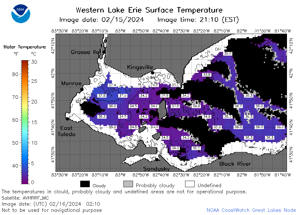 | e1_2024_02_16_0210.png | 16-Feb-2024 09:28 | 43408 | |
 | e1_2024_02_16_0220.png | 16-Feb-2024 09:30 | 19501 | |
 | e1_2024_02_16_0300.png | 16-Feb-2024 09:32 | 44211 | |
 | e1_2024_02_16_0350.png | 16-Feb-2024 09:35 | 19496 | |
 | e1_2024_02_16_0630.png | 16-Feb-2024 10:26 | 42629 | |
 | e1_2024_02_16_0720.png | 16-Feb-2024 10:28 | 43901 | |
 | e1_2024_02_16_0810.png | 16-Feb-2024 12:26 | 37062 | |
 | e1_2024_02_16_0900.png | 16-Feb-2024 12:28 | 22255 | |
 | e1_2024_02_16_0950.png | 16-Feb-2024 14:26 | 19494 | |
 | e1_2024_02_16_1430.png | 16-Feb-2024 18:26 | 22029 | |
 | e1_2024_02_16_1520.png | 16-Feb-2024 18:28 | 22448 | |
 | e1_2024_02_16_1610.png | 16-Feb-2024 20:26 | 22362 | |
 | e1_2024_02_16_1700.png | 16-Feb-2024 20:28 | 22268 | |
 | e1_2024_047.png | 17-Feb-2024 10:15 | 31675 | |