
Easier access to scientific data

Brought to you by NOAA CoastWatch Great Lakes Node
|
ERDDAP
Easier access to scientific data |
|
Brought to you by NOAA CoastWatch Great Lakes Node |
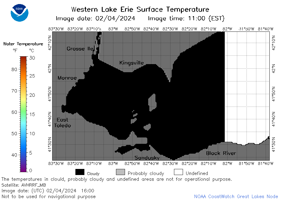
| Dataset Title: | Lake Erie Western Region Surface Temperature Contour Map (2022-present)


|
| Institution: | CoastWatch Great Lakes Node (Dataset ID: LE_NRT_TC_e1) |
| Information: | Summary
| License
| Metadata
| Background | Subset
| Data Access Form
| Make a graph
| Subset
| Data Access Form
| Make a graph
|
![[ICO]](https://apps.glerl.noaa.gov/erddap/images/fileIcons/blank.gif) | Name | Last modified | Size | Description |
|---|---|---|---|---|
![[DIR]](https://apps.glerl.noaa.gov/erddap/images/fileIcons/back.gif) | Parent Directory | - | - | |
![[IMG]](https://apps.glerl.noaa.gov/erddap/images/fileIcons/image2.gif)  | e1_2024_02_04_0120.png | 04-Feb-2024 06:26 | 35263 | |
 | e1_2024_02_04_0210.png | 04-Feb-2024 06:28 | 35283 | |
 | e1_2024_02_04_0300.png | 04-Feb-2024 06:30 | 32210 | |
 | e1_2024_02_04_0350.png | 04-Feb-2024 06:32 | 19484 | |
 | e1_2024_02_04_0650.png | 04-Feb-2024 11:26 | 39781 | |
 | e1_2024_02_04_0830.png | 04-Feb-2024 13:26 | 40430 | |
 | e1_2024_02_04_1420.png | 04-Feb-2024 19:26 | 21197 | |
 | e1_2024_02_04_1430.png | 04-Feb-2024 19:28 | 28707 | |
 | e1_2024_02_04_1520.png | 04-Feb-2024 19:30 | 28487 | |
 | e1_2024_02_04_1600.png | 04-Feb-2024 19:32 | 20320 | |
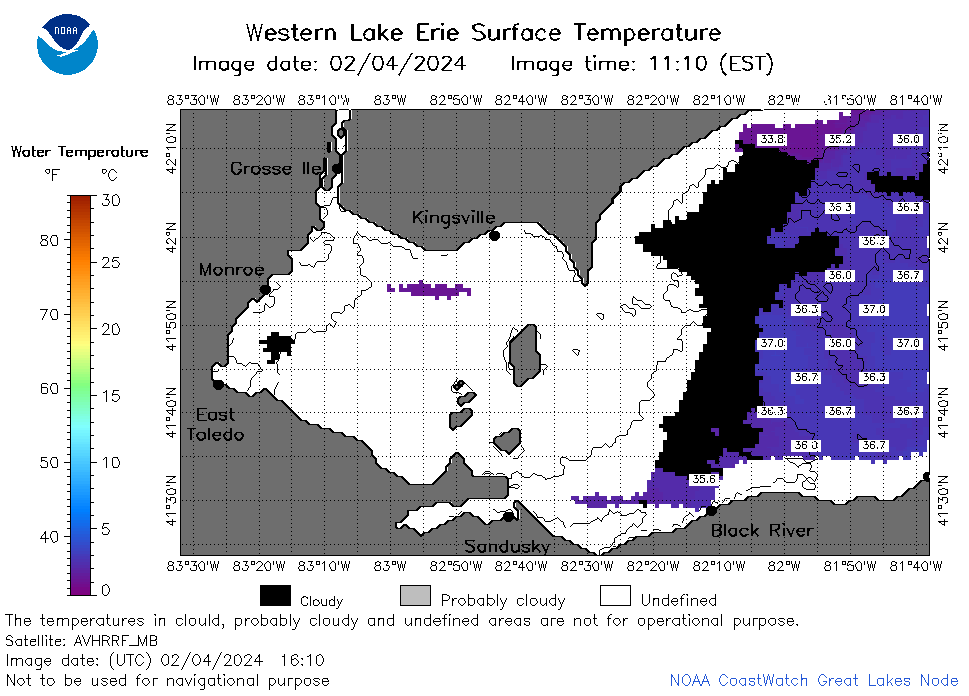 | e1_2024_02_04_1610.png | 04-Feb-2024 19:35 | 29180 | |
 | e1_2024_02_04_1700.png | 04-Feb-2024 21:26 | 22262 | |
 | e1_2024_02_04_1820.png | 04-Feb-2024 21:28 | 33736 | |