
Easier access to scientific data

Brought to you by NOAA CoastWatch Great Lakes Node
|
ERDDAP
Easier access to scientific data |
|
Brought to you by NOAA CoastWatch Great Lakes Node |
| Dataset Title: | Lake Erie Western Region Surface Temperature Contour Map (2022-present)


|
| Institution: | CoastWatch Great Lakes Node (Dataset ID: LE_NRT_TC_e1) |
| Information: | Summary
| License
| Metadata
| Background | Subset
| Data Access Form
| Make a graph
| Subset
| Data Access Form
| Make a graph
|
![[ICO]](https://apps.glerl.noaa.gov/erddap/images/fileIcons/blank.gif) | Name | Last modified | Size | Description |
|---|---|---|---|---|
![[DIR]](https://apps.glerl.noaa.gov/erddap/images/fileIcons/back.gif) | Parent Directory | - | - | |
![[IMG]](https://apps.glerl.noaa.gov/erddap/images/fileIcons/image2.gif)  | e1_2023_11_03_0140.png | 03-Nov-2023 16:26 | 21199 | |
 | e1_2023_11_03_0150.png | 03-Nov-2023 16:28 | 35965 | |
 | e1_2023_11_03_0230.png | 03-Nov-2023 16:30 | 44841 | |
 | e1_2023_11_03_0330.png | 03-Nov-2023 16:33 | 33440 | |
 | e1_2023_11_03_0600.png | 03-Nov-2023 17:26 | 20278 | |
 | e1_2023_11_03_0640.png | 03-Nov-2023 16:35 | 19479 | |
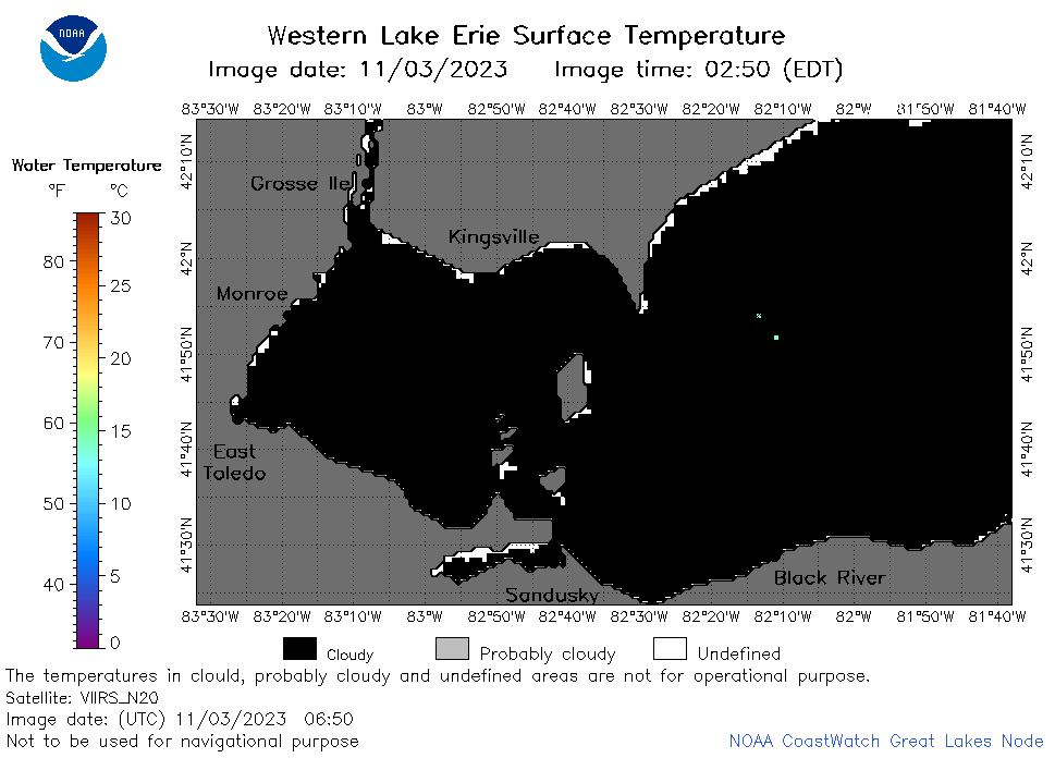 | e1_2023_11_03_0650.png | 03-Nov-2023 16:37 | 20448 | |
 | e1_2023_11_03_0730.png | 03-Nov-2023 17:28 | 19452 | |
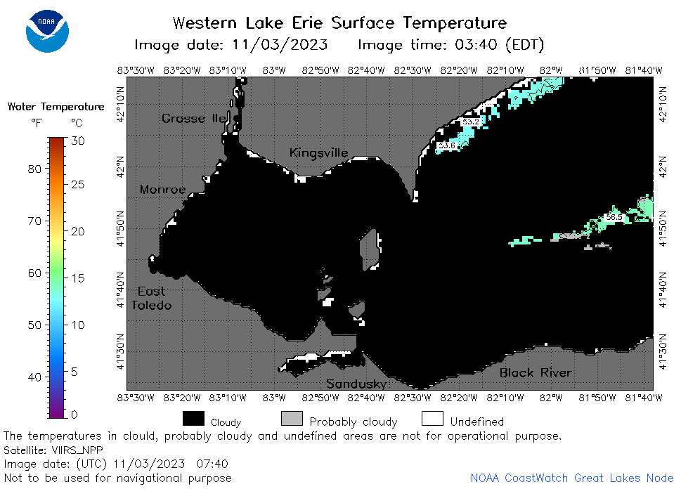 | e1_2023_11_03_0740.png | 03-Nov-2023 17:30 | 22298 | |
 | e1_2023_11_03_0820.png | 03-Nov-2023 17:32 | 19491 | |
 | e1_2023_11_03_0830.png | 03-Nov-2023 17:35 | 20401 | |
 | e1_2023_11_03_0920.png | 03-Nov-2023 17:37 | 19441 | |
 | e1_2023_11_03_1540.png | 03-Nov-2023 19:26 | 39105 | |
 | e1_2023_11_03_1630.png | 03-Nov-2023 19:28 | 31349 | |
 | e1_2023_307.png | 04-Nov-2023 09:15 | 30260 | |