
Easier access to scientific data

Brought to you by NOAA CoastWatch Great Lakes Node
|
ERDDAP
Easier access to scientific data |
|
Brought to you by NOAA CoastWatch Great Lakes Node |
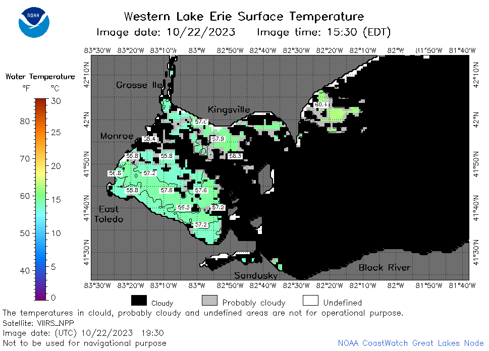
| Dataset Title: | Lake Erie Western Region Surface Temperature Contour Map (2022-present)


|
| Institution: | CoastWatch Great Lakes Node (Dataset ID: LE_NRT_TC_e1) |
| Information: | Summary
| License
| Metadata
| Background | Subset
| Data Access Form
| Make a graph
| Subset
| Data Access Form
| Make a graph
|
![[ICO]](https://apps.glerl.noaa.gov/erddap/images/fileIcons/blank.gif) | Name | Last modified | Size | Description |
|---|---|---|---|---|
![[DIR]](https://apps.glerl.noaa.gov/erddap/images/fileIcons/back.gif) | Parent Directory | - | - | |
![[IMG]](https://apps.glerl.noaa.gov/erddap/images/fileIcons/image2.gif) 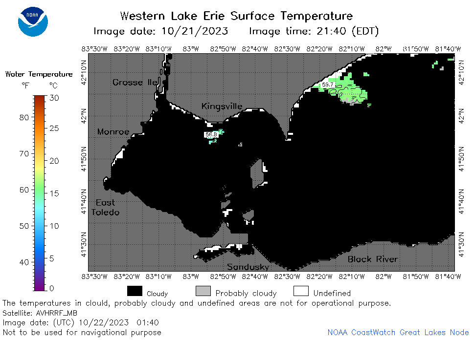 | e1_2023_10_22_0140.png | 22-Oct-2023 05:27 | 21822 | |
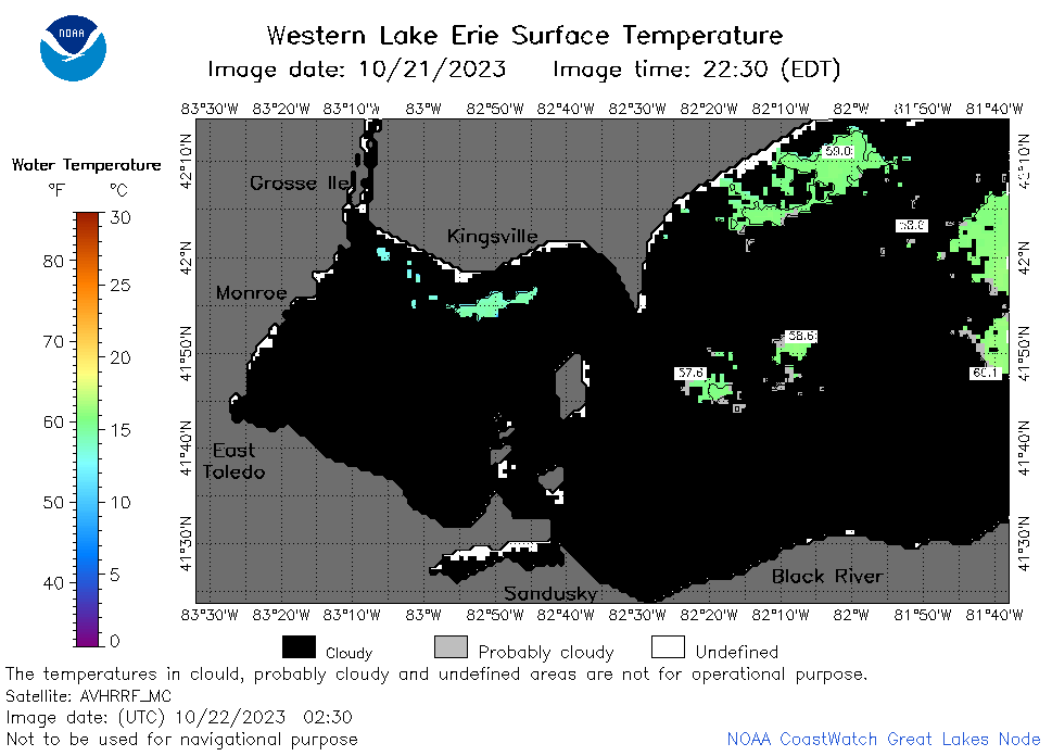 | e1_2023_10_22_0230.png | 22-Oct-2023 05:29 | 24825 | |
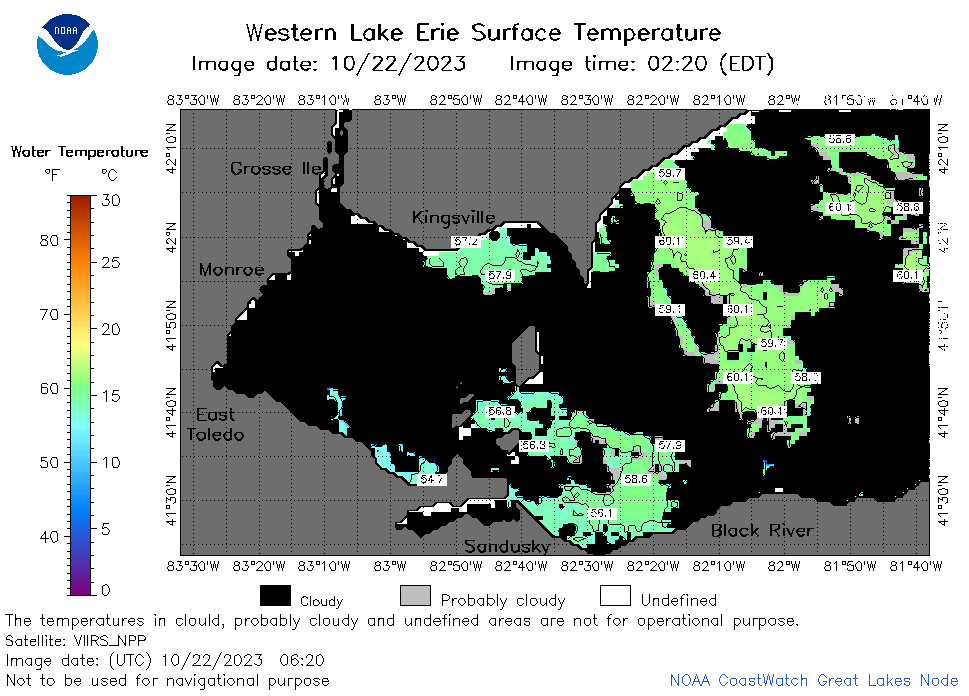
 | e1_2023_10_22_0320.png | 22-Oct-2023 06:25 | 21468 | |
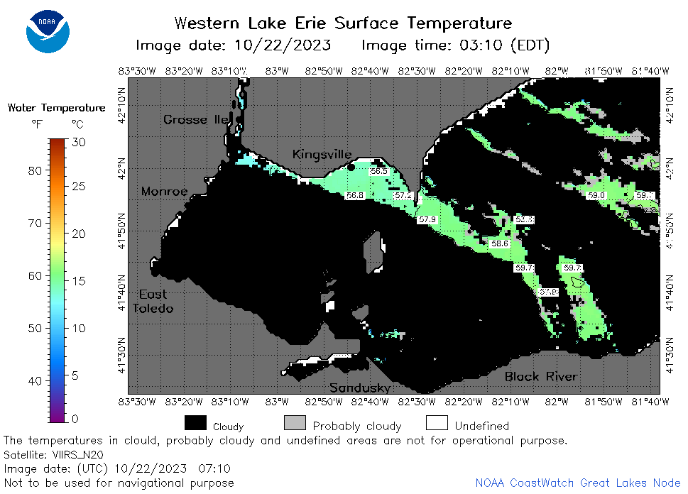
 | e1_2023_10_22_0620.png | 22-Oct-2023 17:25 | 34935 | |
 | e1_2023_10_22_0710.png | 22-Oct-2023 17:28 | 29443 | |
 | e1_2023_10_22_0800.png | 22-Oct-2023 17:30 | 30002 | |
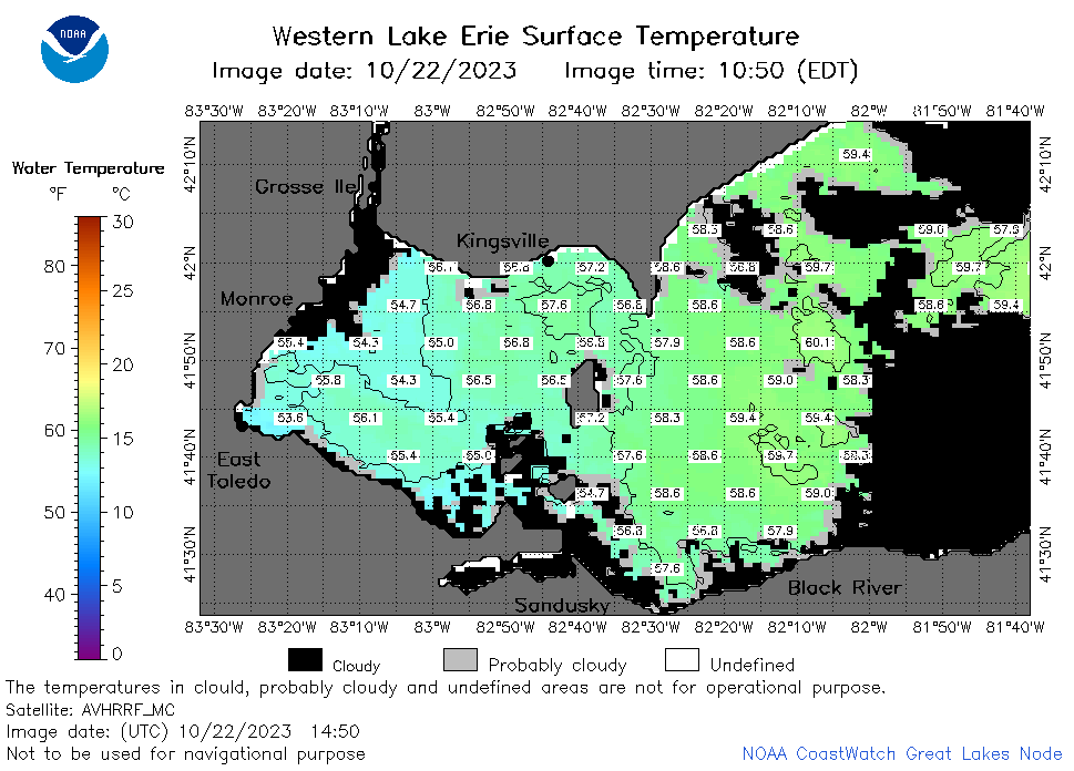 | e1_2023_10_22_1450.png | 22-Oct-2023 19:26 | 38103 | |
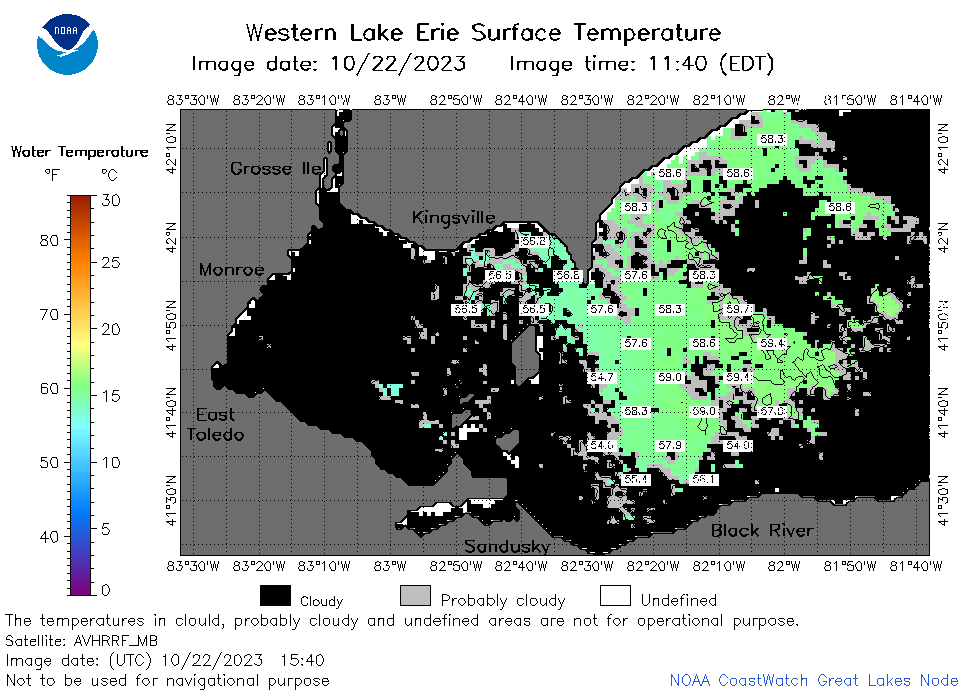 | e1_2023_10_22_1540.png | 22-Oct-2023 19:30 | 35016 | |
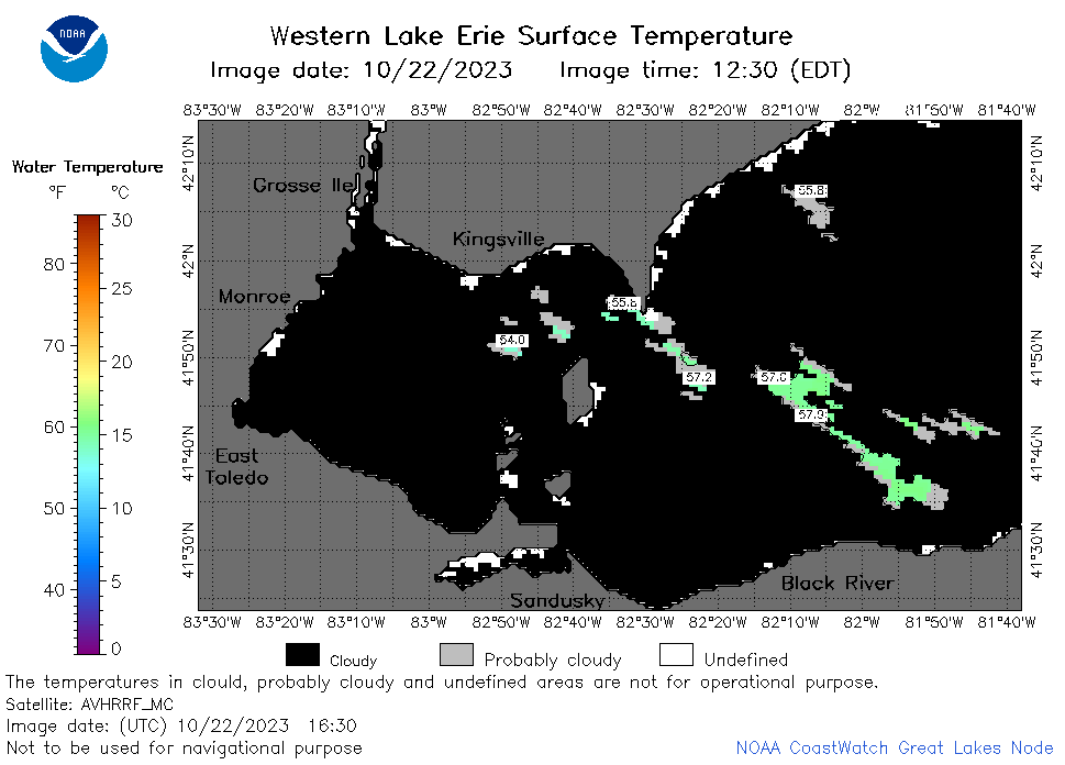 | e1_2023_10_22_1630.png | 22-Oct-2023 20:26 | 22898 | |
 | e1_2023_10_22_1750.png | 22-Oct-2023 22:26 | 25552 | |
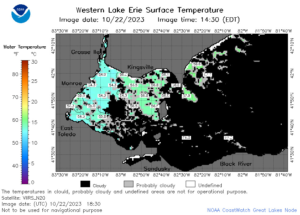 | e1_2023_10_22_1830.png | 22-Oct-2023 21:25 | 29943 | |
 | e1_2023_10_22_1930.png | 22-Oct-2023 23:26 | 27908 | |
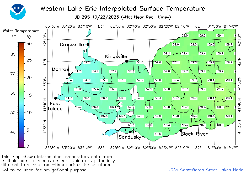 | e1_2023_295.png | 23-Oct-2023 09:15 | 30067 | |