
Easier access to scientific data

Brought to you by NOAA CoastWatch Great Lakes Node
|
ERDDAP
Easier access to scientific data |
|
Brought to you by NOAA CoastWatch Great Lakes Node |
| Dataset Title: | Lake Erie Western Region Surface Temperature Contour Map (2022-present)


|
| Institution: | CoastWatch Great Lakes Node (Dataset ID: LE_NRT_TC_e1) |
| Information: | Summary
| License
| Metadata
| Background | Subset
| Data Access Form
| Make a graph
| Subset
| Data Access Form
| Make a graph
|
![[ICO]](https://apps.glerl.noaa.gov/erddap/images/fileIcons/blank.gif) | Name | Last modified | Size | Description |
|---|---|---|---|---|
![[DIR]](https://apps.glerl.noaa.gov/erddap/images/fileIcons/back.gif) | Parent Directory | - | - | |
![[IMG]](https://apps.glerl.noaa.gov/erddap/images/fileIcons/image2.gif)  | e1_2023_09_29_0300.png | 29-Sep-2023 05:30 | 21874 | |
 | e1_2023_09_29_1510.png | 29-Sep-2023 18:30 | 29192 | |
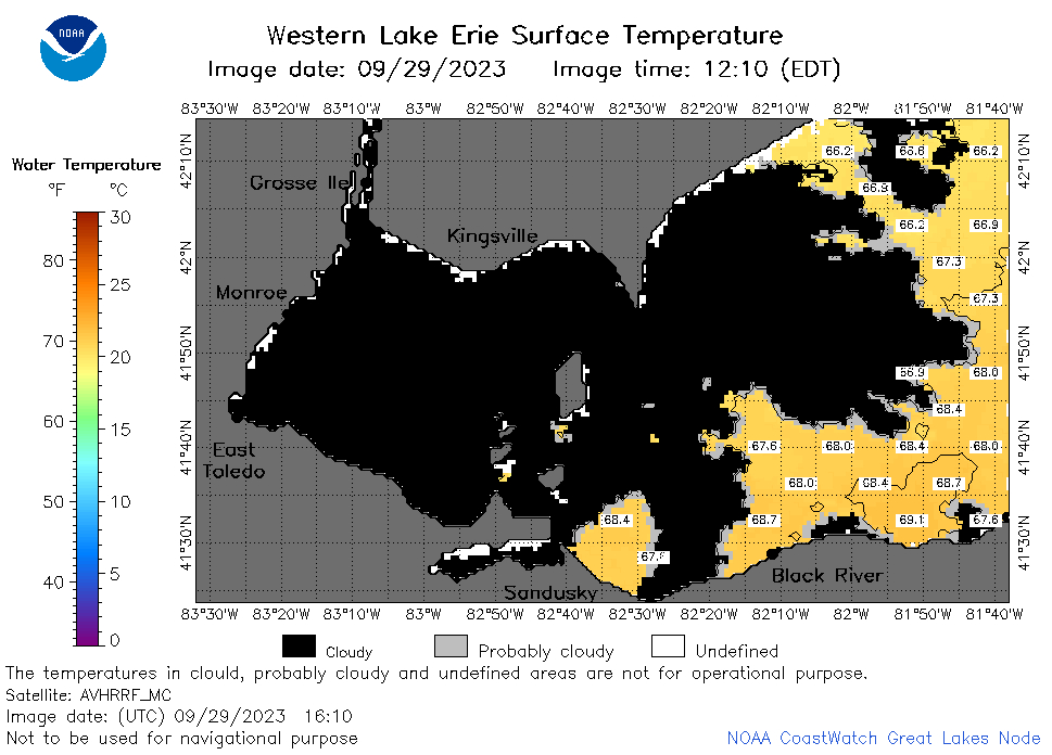 | e1_2023_09_29_1610.png | 29-Sep-2023 21:26 | 28277 | |
 | e1_2023_09_29_1730.png | 29-Sep-2023 19:26 | 30511 | |
 | e1_2023_09_29_1820.png | 29-Sep-2023 22:26 | 31992 | |
 | e1_2023_272.png | 30-Sep-2023 09:15 | 27886 | |