
Easier access to scientific data

Brought to you by NOAA CoastWatch Great Lakes Node
|
ERDDAP
Easier access to scientific data |
|
Brought to you by NOAA CoastWatch Great Lakes Node |
| Dataset Title: | Lake Erie Western Region Surface Temperature Contour Map (2022-present)


|
| Institution: | CoastWatch Great Lakes Node (Dataset ID: LE_NRT_TC_e1) |
| Information: | Summary
| License
| Metadata
| Background | Subset
| Data Access Form
| Make a graph
| Subset
| Data Access Form
| Make a graph
|
![[ICO]](https://apps.glerl.noaa.gov/erddap/images/fileIcons/blank.gif) | Name | Last modified | Size | Description |
|---|---|---|---|---|
![[DIR]](https://apps.glerl.noaa.gov/erddap/images/fileIcons/back.gif) | Parent Directory | - | - | |
![[IMG]](https://apps.glerl.noaa.gov/erddap/images/fileIcons/image2.gif)  | e1_2023_09_15_0200.png | 15-Sep-2023 05:28 | 35912 | |
 | e1_2023_09_15_0250.png | 15-Sep-2023 05:30 | 40026 | |
 | e1_2023_09_15_0620.png | 15-Sep-2023 18:27 | 40536 | |
 | e1_2023_09_15_0710.png | 15-Sep-2023 10:27 | 43887 | |
 | e1_2023_09_15_0800.png | 15-Sep-2023 18:30 | 42926 | |
 | e1_2023_09_15_1420.png | 15-Sep-2023 18:34 | 25422 | |
 | e1_2023_09_15_1500.png | 15-Sep-2023 18:36 | 36053 | |
 | e1_2023_09_15_1600.png | 15-Sep-2023 20:29 | 35761 | |
 | e1_2023_09_15_1740.png | 15-Sep-2023 20:34 | 41005 | |
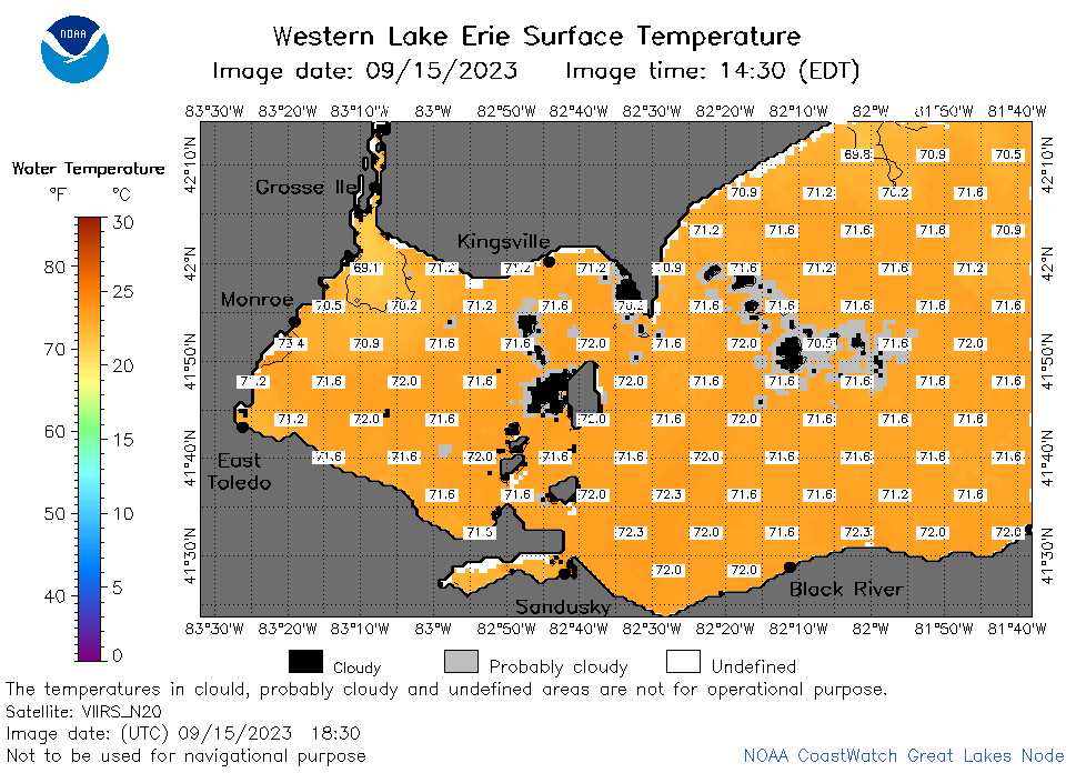 | e1_2023_09_15_1830.png | 15-Sep-2023 21:26 | 35830 | |
 | e1_2023_09_15_1920.png | 15-Sep-2023 22:26 | 39057 | |
 | e1_2023_258.png | 16-Sep-2023 09:15 | 27049 | |