
Easier access to scientific data

Brought to you by NOAA CoastWatch Great Lakes Node
|
ERDDAP
Easier access to scientific data |
|
Brought to you by NOAA CoastWatch Great Lakes Node |
| Dataset Title: | Lake Erie Western Region Surface Temperature Contour Map (2022-present)


|
| Institution: | CoastWatch Great Lakes Node (Dataset ID: LE_NRT_TC_e1) |
| Information: | Summary
| License
| Metadata
| Background | Subset
| Data Access Form
| Make a graph
| Subset
| Data Access Form
| Make a graph
|
![[ICO]](https://apps.glerl.noaa.gov/erddap/images/fileIcons/blank.gif) | Name | Last modified | Size | Description |
|---|---|---|---|---|
![[DIR]](https://apps.glerl.noaa.gov/erddap/images/fileIcons/back.gif) | Parent Directory | - | - | |
![[IMG]](https://apps.glerl.noaa.gov/erddap/images/fileIcons/image2.gif) 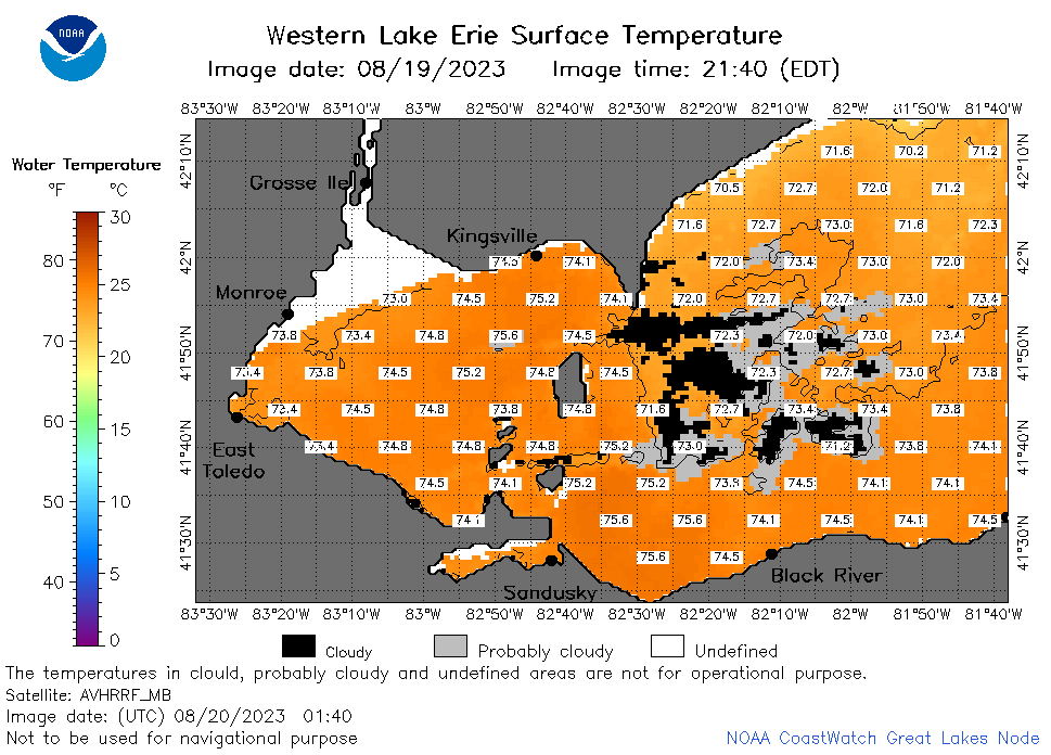 | e1_2023_08_20_0140.png | 20-Aug-2023 05:27 | 41433 | |
 | e1_2023_08_20_0150.png | 20-Aug-2023 05:29 | 22716 | |
 | e1_2023_08_20_0240.png | 20-Aug-2023 05:32 | 42027 | |
 | e1_2023_08_20_0330.png | 20-Aug-2023 06:28 | 36719 | |
 | e1_2023_08_20_0650.png | 20-Aug-2023 10:26 | 39603 | |
 | e1_2023_08_20_0740.png | 20-Aug-2023 11:26 | 40059 | |
 | e1_2023_08_20_0830.png | 20-Aug-2023 11:28 | 41889 | |
 | e1_2023_08_20_1450.png | 20-Aug-2023 19:26 | 37966 | |
 | e1_2023_08_20_1540.png | 20-Aug-2023 19:28 | 41259 | |
 | e1_2023_08_20_1630.png | 20-Aug-2023 20:26 | 38487 | |
 | e1_2023_08_20_1730.png | 20-Aug-2023 20:32 | 41662 | |
 | e1_2023_08_20_1820.png | 20-Aug-2023 20:34 | 42262 | |
 | e1_2023_08_20_1910.png | 20-Aug-2023 23:26 | 42155 | |
 | e1_2023_232.png | 21-Aug-2023 09:15 | 28672 | |