
Easier access to scientific data

Brought to you by NOAA CoastWatch Great Lakes Node
|
ERDDAP
Easier access to scientific data |
|
Brought to you by NOAA CoastWatch Great Lakes Node |
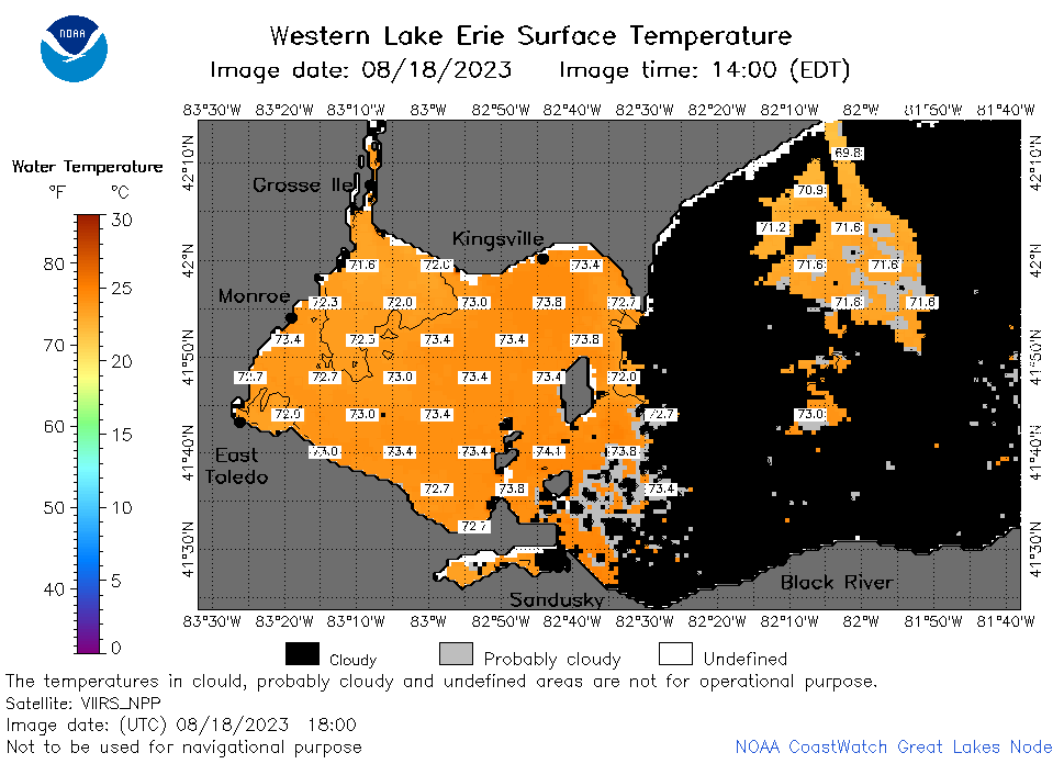
| Dataset Title: | Lake Erie Western Region Surface Temperature Contour Map (2022-present)


|
| Institution: | CoastWatch Great Lakes Node (Dataset ID: LE_NRT_TC_e1) |
| Information: | Summary
| License
| Metadata
| Background | Subset
| Data Access Form
| Make a graph
| Subset
| Data Access Form
| Make a graph
|
![[ICO]](https://apps.glerl.noaa.gov/erddap/images/fileIcons/blank.gif) | Name | Last modified | Size | Description |
|---|---|---|---|---|
![[DIR]](https://apps.glerl.noaa.gov/erddap/images/fileIcons/back.gif) | Parent Directory | - | - | |
![[IMG]](https://apps.glerl.noaa.gov/erddap/images/fileIcons/image2.gif)  | e1_2023_08_18_0140.png | 18-Aug-2023 05:26 | 24761 | |
 | e1_2023_08_18_0230.png | 18-Aug-2023 05:28 | 29770 | |
 | e1_2023_08_18_0320.png | 18-Aug-2023 06:26 | 29489 | |
 | e1_2023_08_18_0640.png | 18-Aug-2023 10:26 | 33870 | |
 | e1_2023_08_18_0730.png | 18-Aug-2023 10:28 | 38452 | |
 | e1_2023_08_18_0820.png | 18-Aug-2023 12:26 | 43203 | |
 | e1_2023_08_18_1440.png | 18-Aug-2023 19:26 | 37075 | |
 | e1_2023_08_18_1540.png | 18-Aug-2023 19:30 | 37762 | |
 | e1_2023_08_18_1620.png | 18-Aug-2023 19:32 | 35753 | |
 | e1_2023_08_18_1710.png | 18-Aug-2023 20:25 | 34825 | |
 | e1_2023_08_18_1800.png | 18-Aug-2023 20:27 | 31383 | |
 | e1_2023_08_18_1850.png | 18-Aug-2023 21:27 | 36138 | |
 | e1_2023_230.png | 19-Aug-2023 09:15 | 28570 | |