
Easier access to scientific data

Brought to you by NOAA CoastWatch Great Lakes Node
|
ERDDAP
Easier access to scientific data |
|
Brought to you by NOAA CoastWatch Great Lakes Node |
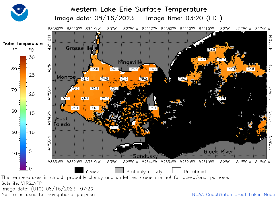
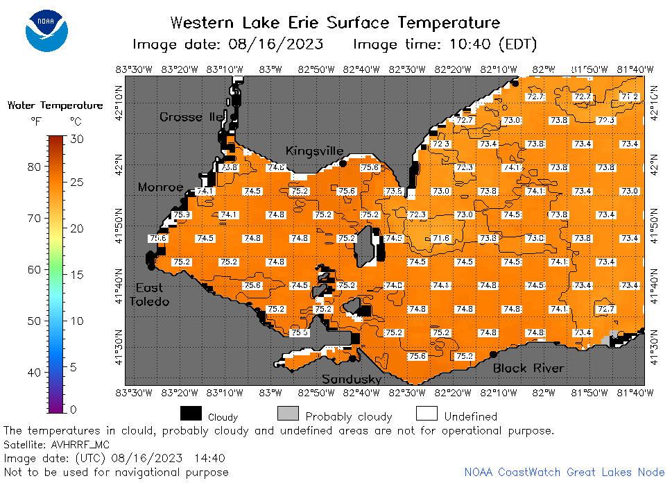
| Dataset Title: | Lake Erie Western Region Surface Temperature Contour Map (2022-present)


|
| Institution: | CoastWatch Great Lakes Node (Dataset ID: LE_NRT_TC_e1) |
| Information: | Summary
| License
| Metadata
| Background | Subset
| Data Access Form
| Make a graph
| Subset
| Data Access Form
| Make a graph
|
![[ICO]](https://apps.glerl.noaa.gov/erddap/images/fileIcons/blank.gif) | Name | Last modified | Size | Description |
|---|---|---|---|---|
![[DIR]](https://apps.glerl.noaa.gov/erddap/images/fileIcons/back.gif) | Parent Directory | - | - | |
![[IMG]](https://apps.glerl.noaa.gov/erddap/images/fileIcons/image2.gif)  | e1_2023_08_16_0130.png | 16-Aug-2023 05:26 | 23041 | |
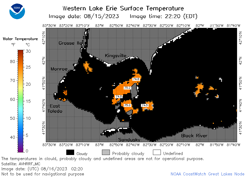 | e1_2023_08_16_0220.png | 16-Aug-2023 05:28 | 24658 | |
 | e1_2023_08_16_0310.png | 16-Aug-2023 05:30 | 26732 | |
 | e1_2023_08_16_0630.png | 16-Aug-2023 09:26 | 33960 | |
 | e1_2023_08_16_0720.png | 16-Aug-2023 11:26 | 37147 | |
 | e1_2023_08_16_0810.png | 16-Aug-2023 11:28 | 37109 | |
 | e1_2023_08_16_1440.png | 16-Aug-2023 18:28 | 36962 | |
 | e1_2023_08_16_1520.png | 16-Aug-2023 18:30 | 40862 | |
 | e1_2023_08_16_1620.png | 16-Aug-2023 20:28 | 37600 | |
 | e1_2023_08_16_1700.png | 16-Aug-2023 19:26 | 34972 | |
 | e1_2023_08_16_1750.png | 16-Aug-2023 20:32 | 40145 | |
 | e1_2023_08_16_1840.png | 16-Aug-2023 21:28 | 40732 | |
 | e1_2023_08_16_1930.png | 16-Aug-2023 22:28 | 31771 | |
 | e1_2023_228.png | 17-Aug-2023 09:15 | 27648 | |