
Easier access to scientific data

Brought to you by NOAA CoastWatch Great Lakes Node
|
ERDDAP
Easier access to scientific data |
|
Brought to you by NOAA CoastWatch Great Lakes Node |
| Dataset Title: | Lake Erie Western Region Surface Temperature Contour Map (2022-present)


|
| Institution: | CoastWatch Great Lakes Node (Dataset ID: LE_NRT_TC_e1) |
| Information: | Summary
| License
| Metadata
| Background | Subset
| Data Access Form
| Make a graph
| Subset
| Data Access Form
| Make a graph
|
![[ICO]](https://apps.glerl.noaa.gov/erddap/images/fileIcons/blank.gif) | Name | Last modified | Size | Description |
|---|---|---|---|---|
![[DIR]](https://apps.glerl.noaa.gov/erddap/images/fileIcons/back.gif) | Parent Directory | - | - | |
![[IMG]](https://apps.glerl.noaa.gov/erddap/images/fileIcons/image2.gif)  | e1_2023_07_28_0120.png | 28-Jul-2023 05:25 | 41137 | |
 | e1_2023_07_28_0210.png | 28-Jul-2023 05:28 | 39701 | |
 | e1_2023_07_28_0300.png | 28-Jul-2023 05:32 | 38825 | |
 | e1_2023_07_28_0630.png | 28-Jul-2023 17:26 | 24795 | |
 | e1_2023_07_28_0640.png | 28-Jul-2023 17:28 | 38018 | |
 | e1_2023_07_28_0720.png | 28-Jul-2023 10:26 | 23517 | |
 | e1_2023_07_28_0730.png | 28-Jul-2023 10:28 | 44435 | |
 | e1_2023_07_28_0820.png | 28-Jul-2023 17:32 | 46317 | |
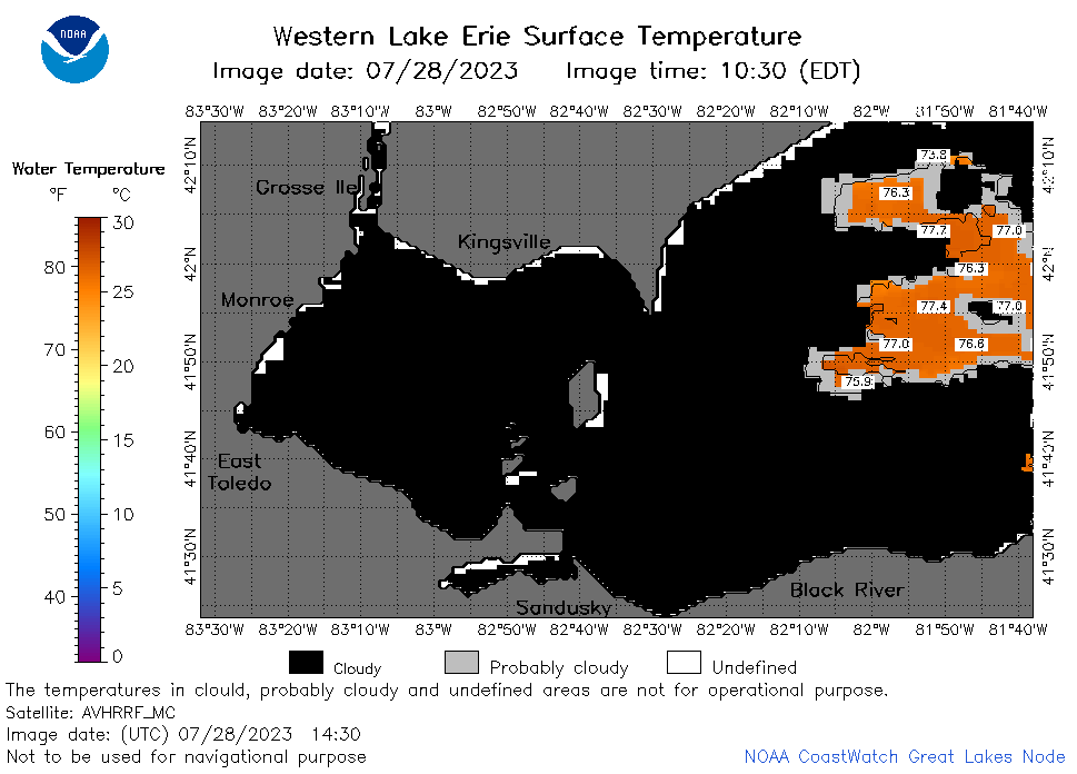 | e1_2023_07_28_1430.png | 28-Jul-2023 18:26 | 23577 | |
 | e1_2023_07_28_1800.png | 28-Jul-2023 20:30 | 24322 | |
 | e1_2023_07_28_1850.png | 28-Jul-2023 21:26 | 24227 | |