
Easier access to scientific data

Brought to you by NOAA CoastWatch Great Lakes Node
|
ERDDAP
Easier access to scientific data |
|
Brought to you by NOAA CoastWatch Great Lakes Node |
| Dataset Title: | Lake Erie Western Region Surface Temperature Contour Map (2022-present)


|
| Institution: | CoastWatch Great Lakes Node (Dataset ID: LE_NRT_TC_e1) |
| Information: | Summary
| License
| Metadata
| Background | Subset
| Data Access Form
| Make a graph
| Subset
| Data Access Form
| Make a graph
|
![[ICO]](https://apps.glerl.noaa.gov/erddap/images/fileIcons/blank.gif) | Name | Last modified | Size | Description |
|---|---|---|---|---|
![[DIR]](https://apps.glerl.noaa.gov/erddap/images/fileIcons/back.gif) | Parent Directory | - | - | |
![[IMG]](https://apps.glerl.noaa.gov/erddap/images/fileIcons/image2.gif)  | e1_2023_07_04_0120.png | 04-Jul-2023 05:26 | 44852 | |
 | e1_2023_07_04_0210.png | 04-Jul-2023 05:28 | 44684 | |
 | e1_2023_07_04_0300.png | 04-Jul-2023 05:30 | 45782 | |
 | e1_2023_07_04_0630.png | 04-Jul-2023 10:26 | 45470 | |
 | e1_2023_07_04_0730.png | 04-Jul-2023 11:28 | 42917 | |
 | e1_2023_07_04_0810.png | 04-Jul-2023 11:30 | 28363 | |
 | e1_2023_07_04_0820.png | 04-Jul-2023 11:32 | 35421 | |
 | e1_2023_07_04_1430.png | 04-Jul-2023 18:28 | 35321 | |
 | e1_2023_07_04_1510.png | 04-Jul-2023 18:30 | 44805 | |
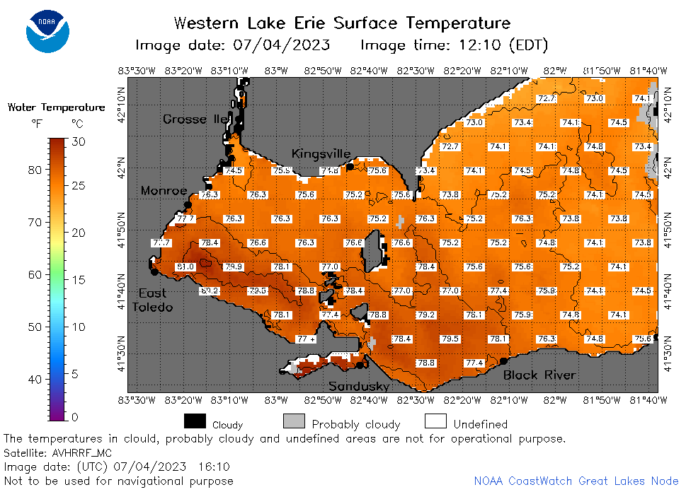 | e1_2023_07_04_1610.png | 04-Jul-2023 20:28 | 43325 | |
 | e1_2023_07_04_1710.png | 04-Jul-2023 20:34 | 45358 | |
 | e1_2023_07_04_1800.png | 04-Jul-2023 20:37 | 44810 | |
 | e1_2023_07_04_1850.png | 04-Jul-2023 21:26 | 44966 | |
 | e1_2023_185.png | 05-Jul-2023 09:15 | 29189 | |