
Easier access to scientific data

Brought to you by NOAA CoastWatch Great Lakes Node
|
ERDDAP
Easier access to scientific data |
|
Brought to you by NOAA CoastWatch Great Lakes Node |
| Dataset Title: | Lake Erie Western Region Surface Temperature Contour Map (2022-present)


|
| Institution: | CoastWatch Great Lakes Node (Dataset ID: LE_NRT_TC_e1) |
| Information: | Summary
| License
| Metadata
| Background | Subset
| Data Access Form
| Make a graph
| Subset
| Data Access Form
| Make a graph
|
![[ICO]](https://apps.glerl.noaa.gov/erddap/images/fileIcons/blank.gif) | Name | Last modified | Size | Description |
|---|---|---|---|---|
![[DIR]](https://apps.glerl.noaa.gov/erddap/images/fileIcons/back.gif) | Parent Directory | - | - | |
![[IMG]](https://apps.glerl.noaa.gov/erddap/images/fileIcons/image2.gif)  | e1_2023_07_01_0130.png | 01-Jul-2023 05:26 | 26990 | |
 | e1_2023_07_01_0220.png | 01-Jul-2023 05:30 | 46077 | |
 | e1_2023_07_01_0310.png | 01-Jul-2023 06:26 | 31215 | |
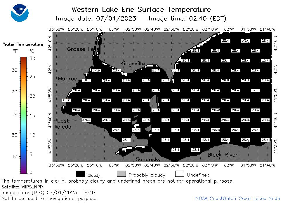 | e1_2023_07_01_0640.png | 01-Jul-2023 10:26 | 22404 | |
 | e1_2023_07_01_0730.png | 01-Jul-2023 10:28 | 26299 | |
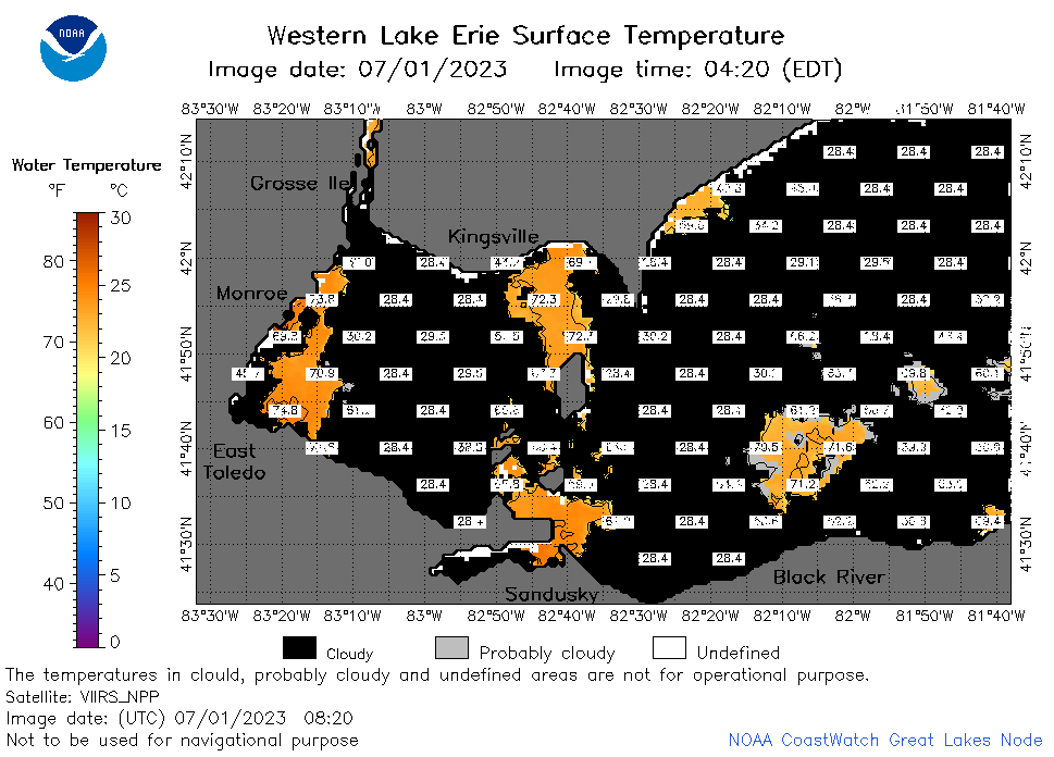 | e1_2023_07_01_0820.png | 01-Jul-2023 12:26 | 33043 | |
 | e1_2023_07_01_1440.png | 01-Jul-2023 18:28 | 22965 | |
 | e1_2023_07_01_1530.png | 01-Jul-2023 19:26 | 22102 | |
 | e1_2023_07_01_1620.png | 01-Jul-2023 19:30 | 22542 | |
 | e1_2023_07_01_1710.png | 01-Jul-2023 20:25 | 22103 | |
 | e1_2023_07_01_1800.png | 01-Jul-2023 20:28 | 22159 | |
 | e1_2023_07_01_1850.png | 01-Jul-2023 21:28 | 22127 | |
 | e1_2023_182.png | 02-Jul-2023 09:15 | 30002 | |