
Easier access to scientific data

Brought to you by NOAA CoastWatch Great Lakes Node
|
ERDDAP
Easier access to scientific data |
|
Brought to you by NOAA CoastWatch Great Lakes Node |
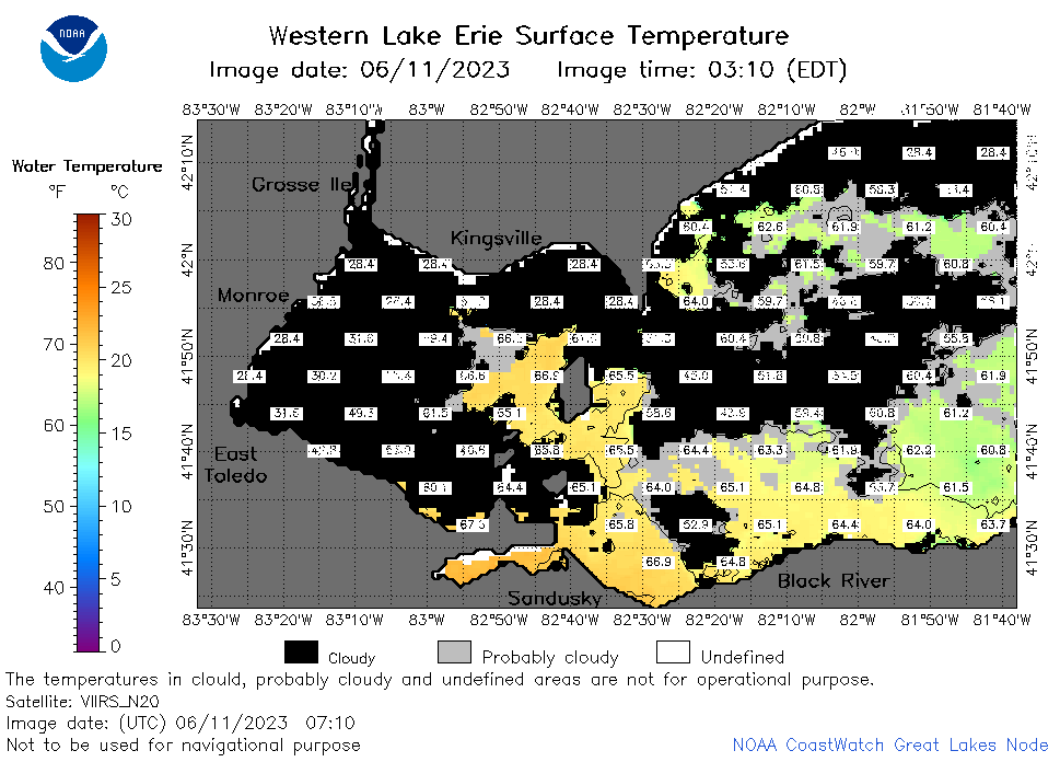
| Dataset Title: | Lake Erie Western Region Surface Temperature Contour Map (2022-present)


|
| Institution: | CoastWatch Great Lakes Node (Dataset ID: LE_NRT_TC_e1) |
| Information: | Summary
| License
| Metadata
| Background | Subset
| Data Access Form
| Make a graph
| Subset
| Data Access Form
| Make a graph
|
![[ICO]](https://apps.glerl.noaa.gov/erddap/images/fileIcons/blank.gif) | Name | Last modified | Size | Description |
|---|---|---|---|---|
![[DIR]](https://apps.glerl.noaa.gov/erddap/images/fileIcons/back.gif) | Parent Directory | - | - | |
![[IMG]](https://apps.glerl.noaa.gov/erddap/images/fileIcons/image2.gif)  | e1_2023_06_11_0150.png | 11-Jun-2023 05:28 | 47999 | |
 | e1_2023_06_11_0230.png | 11-Jun-2023 05:30 | 52243 | |
 | e1_2023_06_11_0330.png | 11-Jun-2023 06:26 | 33873 | |
 | e1_2023_06_11_0620.png | 11-Jun-2023 10:28 | 23815 | |
 | e1_2023_06_11_0710.png | 11-Jun-2023 10:30 | 38551 | |
 | e1_2023_06_11_0800.png | 11-Jun-2023 11:28 | 26458 | |
 | e1_2023_06_11_1450.png | 11-Jun-2023 18:28 | 23238 | |
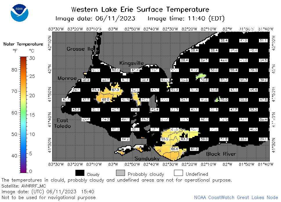 | e1_2023_06_11_1540.png | 11-Jun-2023 19:26 | 28615 | |
 | e1_2023_06_11_1630.png | 11-Jun-2023 19:28 | 24976 | |
 | e1_2023_06_11_1740.png | 11-Jun-2023 20:26 | 23592 | |
 | e1_2023_06_11_1830.png | 11-Jun-2023 21:28 | 22139 | |
 | e1_2023_06_11_1920.png | 11-Jun-2023 22:26 | 22009 | |
 | e1_2023_162.png | 12-Jun-2023 09:16 | 31054 | |