
Easier access to scientific data

Brought to you by NOAA CoastWatch Great Lakes Node
|
ERDDAP
Easier access to scientific data |
|
Brought to you by NOAA CoastWatch Great Lakes Node |
| Dataset Title: | Lake Erie Western Region Surface Temperature Contour Map (2022-present)


|
| Institution: | CoastWatch Great Lakes Node (Dataset ID: LE_NRT_TC_e1) |
| Information: | Summary
| License
| Metadata
| Background | Subset
| Data Access Form
| Make a graph
| Subset
| Data Access Form
| Make a graph
|
![[ICO]](https://apps.glerl.noaa.gov/erddap/images/fileIcons/blank.gif) | Name | Last modified | Size | Description |
|---|---|---|---|---|
![[DIR]](https://apps.glerl.noaa.gov/erddap/images/fileIcons/back.gif) | Parent Directory | - | - | |
![[IMG]](https://apps.glerl.noaa.gov/erddap/images/fileIcons/image2.gif)  | e1_2023_05_13_0150.png | 13-May-2023 05:27 | 22141 | |
 | e1_2023_05_13_0230.png | 13-May-2023 05:30 | 22832 | |
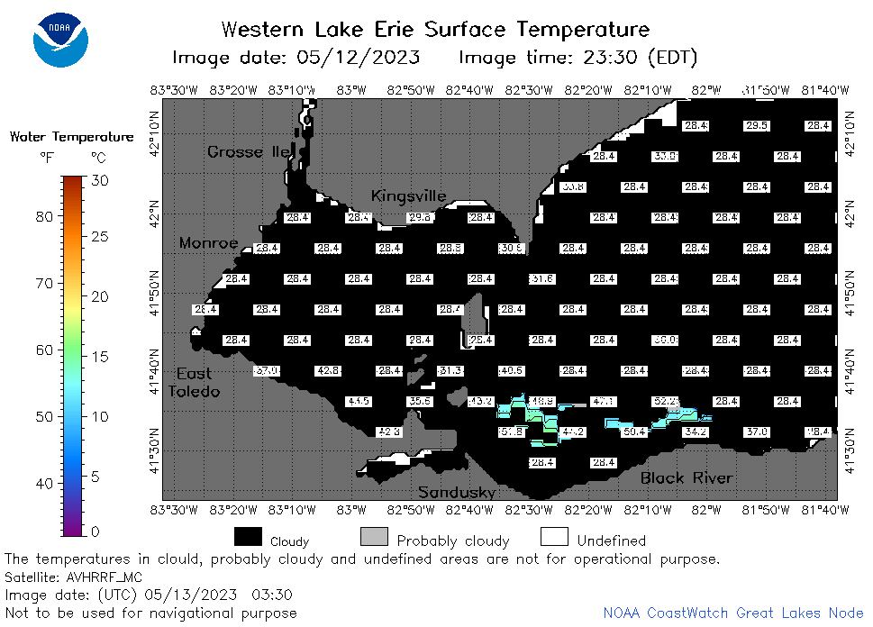 | e1_2023_05_13_0330.png | 13-May-2023 06:26 | 23944 | |
 | e1_2023_05_13_0610.png | 13-May-2023 09:25 | 23159 | |
 | e1_2023_05_13_0700.png | 13-May-2023 10:26 | 23737 | |
 | e1_2023_05_13_0750.png | 13-May-2023 10:28 | 22241 | |
 | e1_2023_05_13_0840.png | 13-May-2023 12:26 | 22784 | |
 | e1_2023_05_13_1450.png | 13-May-2023 18:28 | 22235 | |
 | e1_2023_05_13_1540.png | 13-May-2023 19:26 | 23927 | |
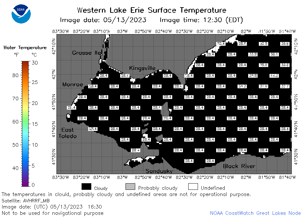 | e1_2023_05_13_1630.png | 13-May-2023 19:28 | 22633 | |
 | e1_2023_05_13_1730.png | 13-May-2023 20:26 | 22931 | |
 | e1_2023_05_13_1820.png | 13-May-2023 21:27 | 22499 | |
 | e1_2023_05_13_1910.png | 13-May-2023 22:28 | 22791 | |
 | e1_2023_133.png | 14-May-2023 09:15 | 33299 | |