
Easier access to scientific data

Brought to you by NOAA CoastWatch Great Lakes Node
|
ERDDAP
Easier access to scientific data |
|
Brought to you by NOAA CoastWatch Great Lakes Node |
| Dataset Title: | Lake Erie Western Region Surface Temperature Contour Map (2022-present)


|
| Institution: | CoastWatch Great Lakes Node (Dataset ID: LE_NRT_TC_e1) |
| Information: | Summary
| License
| Metadata
| Background | Subset
| Data Access Form
| Make a graph
| Subset
| Data Access Form
| Make a graph
|
![[ICO]](https://apps.glerl.noaa.gov/erddap/images/fileIcons/blank.gif) | Name | Last modified | Size | Description |
|---|---|---|---|---|
![[DIR]](https://apps.glerl.noaa.gov/erddap/images/fileIcons/back.gif) | Parent Directory | - | - | |
![[IMG]](https://apps.glerl.noaa.gov/erddap/images/fileIcons/image2.gif)  | e1_2023_05_01_0140.png | 01-May-2023 16:27 | 42808 | |
 | e1_2023_05_01_0230.png | 01-May-2023 16:31 | 34500 | |
 | e1_2023_05_01_0320.png | 01-May-2023 16:35 | 28961 | |
 | e1_2023_05_01_0630.png | 01-May-2023 16:39 | 22527 | |
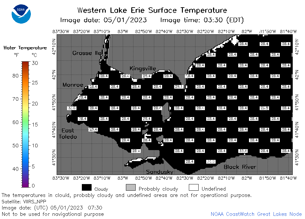 | e1_2023_05_01_0730.png | 01-May-2023 16:43 | 22315 | |
 | e1_2023_05_01_0810.png | 01-May-2023 16:45 | 22349 | |
 | e1_2023_05_01_1450.png | 01-May-2023 18:26 | 24870 | |
 | e1_2023_05_01_1540.png | 01-May-2023 18:28 | 26516 | |
 | e1_2023_05_01_1630.png | 01-May-2023 20:26 | 23236 | |
 | e1_2023_05_01_1710.png | 01-May-2023 20:28 | 22603 | |
 | e1_2023_05_01_1800.png | 01-May-2023 20:32 | 24207 | |
 | e1_2023_05_01_1850.png | 01-May-2023 21:25 | 26710 | |