
Easier access to scientific data

Brought to you by NOAA CoastWatch Great Lakes Node
|
ERDDAP
Easier access to scientific data |
|
Brought to you by NOAA CoastWatch Great Lakes Node |
| Dataset Title: | Lake Erie Western Region Surface Temperature Contour Map (2022-present)


|
| Institution: | CoastWatch Great Lakes Node (Dataset ID: LE_NRT_TC_e1) |
| Information: | Summary
| License
| Metadata
| Background | Subset
| Data Access Form
| Make a graph
| Subset
| Data Access Form
| Make a graph
|
![[ICO]](https://apps.glerl.noaa.gov/erddap/images/fileIcons/blank.gif) | Name | Last modified | Size | Description |
|---|---|---|---|---|
![[DIR]](https://apps.glerl.noaa.gov/erddap/images/fileIcons/back.gif) | Parent Directory | - | - | |
![[IMG]](https://apps.glerl.noaa.gov/erddap/images/fileIcons/image2.gif)  | e1_2023_04_28_0200.png | 28-Apr-2023 05:30 | 29113 | |
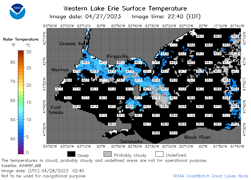 | e1_2023_04_28_0240.png | 28-Apr-2023 05:32 | 35579 | |
 | e1_2023_04_28_0340.png | 28-Apr-2023 06:26 | 22227 | |
 | e1_2023_04_28_0640.png | 28-Apr-2023 18:26 | 24302 | |
 | e1_2023_04_28_0730.png | 28-Apr-2023 18:28 | 22383 | |
 | e1_2023_04_28_0820.png | 28-Apr-2023 18:30 | 22161 | |
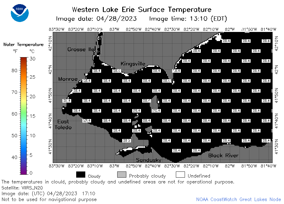
 | e1_2023_04_28_1410.png | 28-Apr-2023 18:34 | 20799 | |
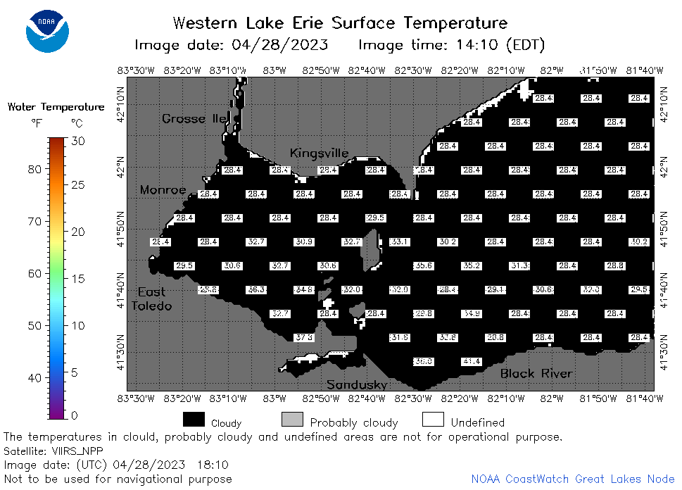
 | e1_2023_04_28_1500.png | 28-Apr-2023 18:36 | 22208 | |
 | e1_2023_04_28_1550.png | 28-Apr-2023 19:26 | 22193 | |
 | e1_2023_04_28_1640.png | 28-Apr-2023 19:28 | 21488 | |
 | e1_2023_04_28_1710.png | 28-Apr-2023 20:25 | 22122 | |
 | e1_2023_04_28_1810.png | 28-Apr-2023 22:26 | 23083 | |
 | e1_2023_04_28_1850.png | 28-Apr-2023 21:29 | 23408 | |