
Easier access to scientific data

Brought to you by NOAA CoastWatch Great Lakes Node
|
ERDDAP
Easier access to scientific data |
|
Brought to you by NOAA CoastWatch Great Lakes Node |
| Dataset Title: | Lake Erie Western Region Surface Temperature Contour Map (2022-present)


|
| Institution: | CoastWatch Great Lakes Node (Dataset ID: LE_NRT_TC_e1) |
| Information: | Summary
| License
| Metadata
| Background | Subset
| Data Access Form
| Make a graph
| Subset
| Data Access Form
| Make a graph
|
![[ICO]](https://apps.glerl.noaa.gov/erddap/images/fileIcons/blank.gif) | Name | Last modified | Size | Description |
|---|---|---|---|---|
![[DIR]](https://apps.glerl.noaa.gov/erddap/images/fileIcons/back.gif) | Parent Directory | - | - | |
![[IMG]](https://apps.glerl.noaa.gov/erddap/images/fileIcons/image2.gif)  | e1_2023_04_26_0150.png | 26-Apr-2023 16:28 | 25678 | |
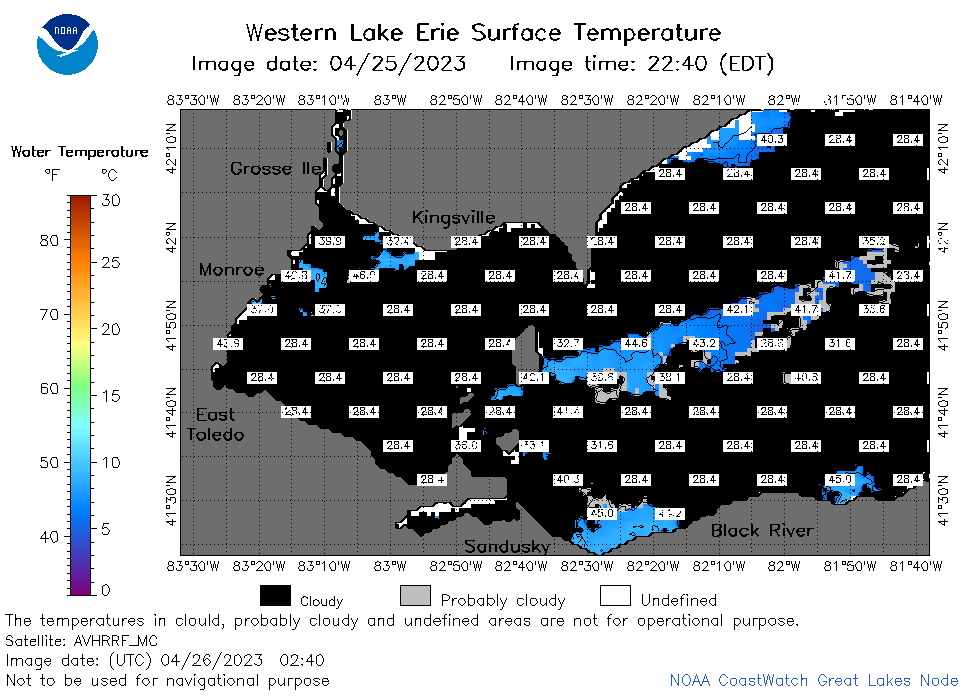 | e1_2023_04_26_0240.png | 26-Apr-2023 16:30 | 30518 | |
 | e1_2023_04_26_0330.png | 26-Apr-2023 16:32 | 28198 | |
 | e1_2023_04_26_0630.png | 26-Apr-2023 16:34 | 42783 | |
 | e1_2023_04_26_0720.png | 26-Apr-2023 16:37 | 49752 | |
 | e1_2023_04_26_0810.png | 26-Apr-2023 16:39 | 46171 | |
 | e1_2023_04_26_1500.png | 26-Apr-2023 20:28 | 38495 | |
 | e1_2023_04_26_1540.png | 26-Apr-2023 18:26 | 44487 | |
 | e1_2023_04_26_1630.png | 26-Apr-2023 20:30 | 28185 | |
 | e1_2023_04_26_1640.png | 26-Apr-2023 20:32 | 36635 | |
 | e1_2023_04_26_1700.png | 26-Apr-2023 20:34 | 37295 | |
 | e1_2023_04_26_1840.png | 26-Apr-2023 21:28 | 44333 | |
 | e1_2023_04_26_1930.png | 26-Apr-2023 22:26 | 33468 | |