
Easier access to scientific data

Brought to you by NOAA CoastWatch Great Lakes Node
|
ERDDAP
Easier access to scientific data |
|
Brought to you by NOAA CoastWatch Great Lakes Node |
| Dataset Title: | Lake Erie Western Region Surface Temperature Contour Map (2022-present)


|
| Institution: | CoastWatch Great Lakes Node (Dataset ID: LE_NRT_TC_e1) |
| Information: | Summary
| License
| Metadata
| Background | Subset
| Data Access Form
| Make a graph
| Subset
| Data Access Form
| Make a graph
|
![[ICO]](https://apps.glerl.noaa.gov/erddap/images/fileIcons/blank.gif) | Name | Last modified | Size | Description |
|---|---|---|---|---|
![[DIR]](https://apps.glerl.noaa.gov/erddap/images/fileIcons/back.gif) | Parent Directory | - | - | |
![[IMG]](https://apps.glerl.noaa.gov/erddap/images/fileIcons/image2.gif) 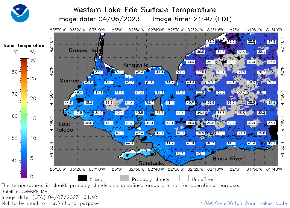 | e1_2023_04_07_0140.png | 07-Apr-2023 05:26 | 56119 | |
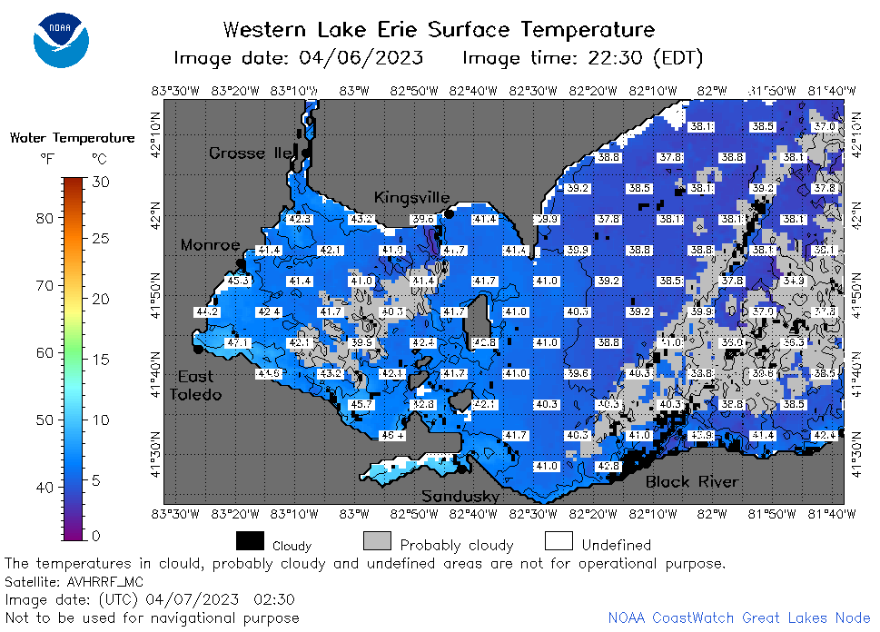 | e1_2023_04_07_0230.png | 07-Apr-2023 05:28 | 55464 | |
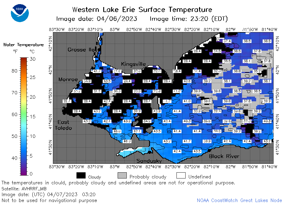 | e1_2023_04_07_0320.png | 07-Apr-2023 06:26 | 43596 | |
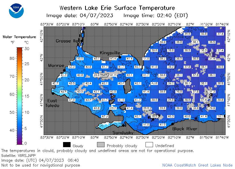 | e1_2023_04_07_0640.png | 07-Apr-2023 10:28 | 54659 | |
 | e1_2023_04_07_0720.png | 07-Apr-2023 10:30 | 50242 | |
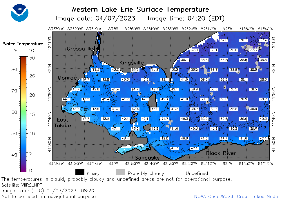 | e1_2023_04_07_0820.png | 07-Apr-2023 12:28 | 53396 | |
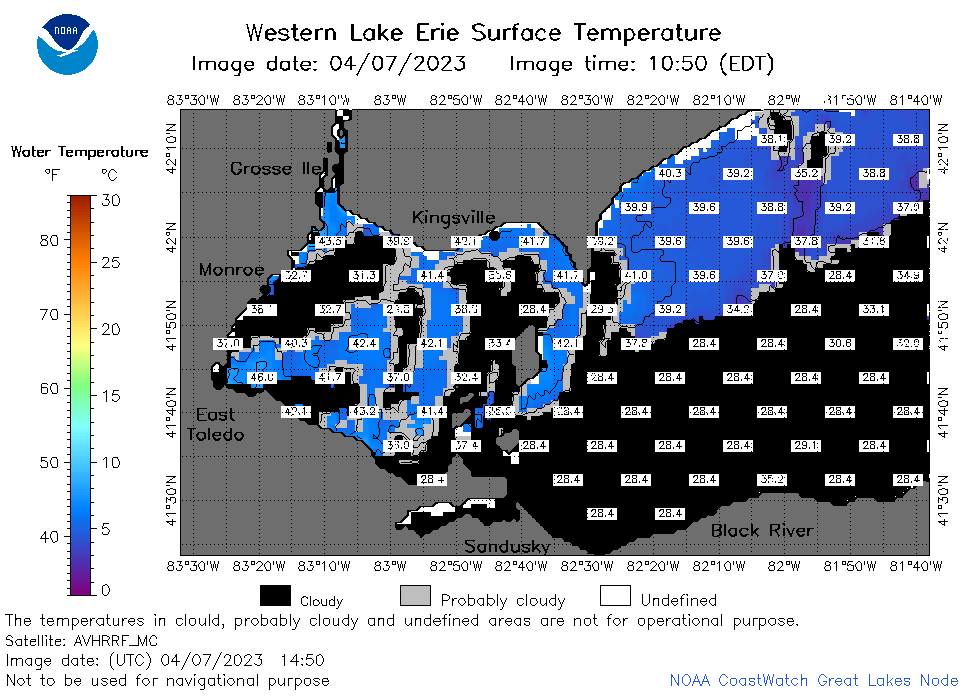 | e1_2023_04_07_1450.png | 07-Apr-2023 19:26 | 34527 | |
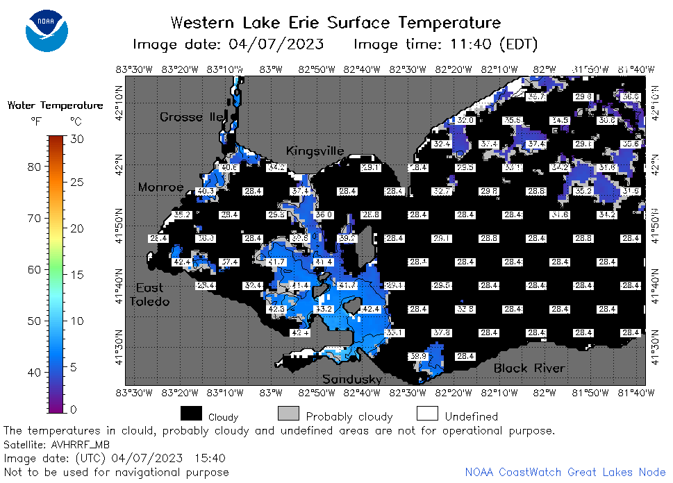 | e1_2023_04_07_1540.png | 07-Apr-2023 18:28 | 36488 | |
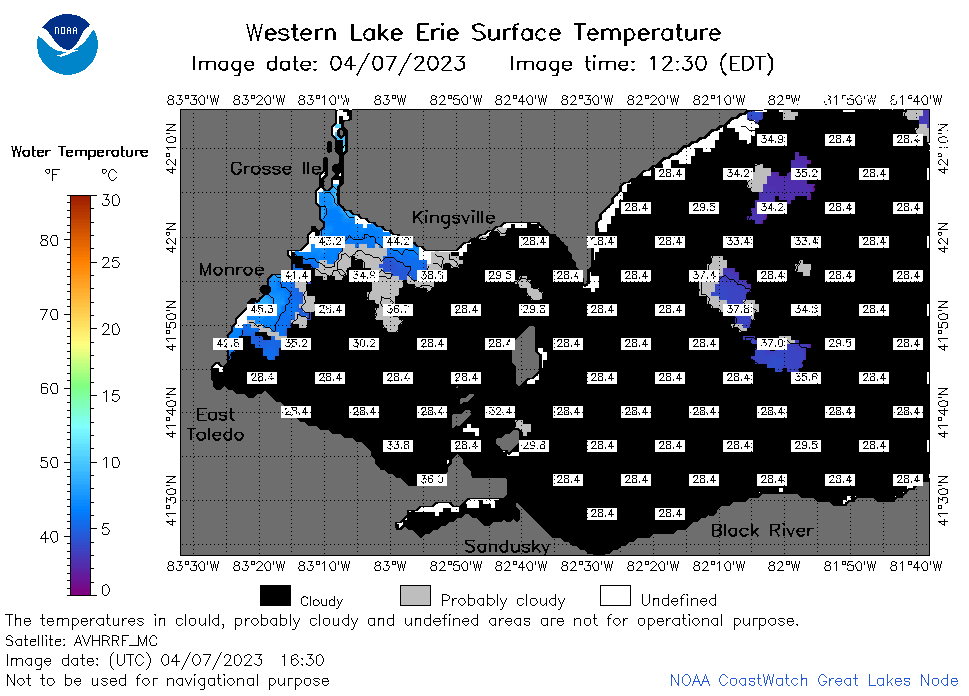 | e1_2023_04_07_1630.png | 07-Apr-2023 20:26 | 27769 | |
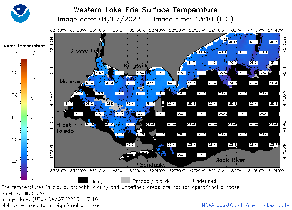 | e1_2023_04_07_1710.png | 07-Apr-2023 20:30 | 40478 | |
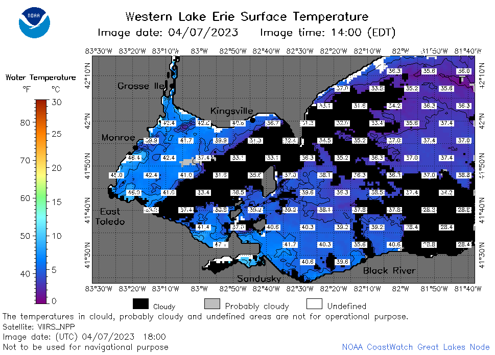 | e1_2023_04_07_1800.png | 07-Apr-2023 20:34 | 48928 | |
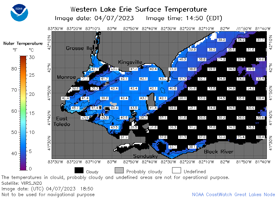 | e1_2023_04_07_1850.png | 07-Apr-2023 21:26 | 41168 | |
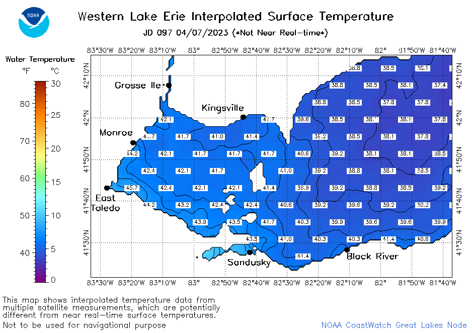 | e1_2023_097.png | 08-Apr-2023 09:15 | 30794 | |