
Easier access to scientific data

Brought to you by NOAA CoastWatch Great Lakes Node
|
ERDDAP
Easier access to scientific data |
|
Brought to you by NOAA CoastWatch Great Lakes Node |
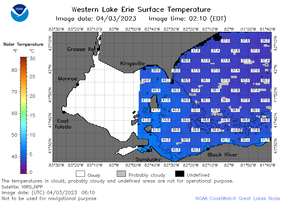
| Dataset Title: | Lake Erie Western Region Surface Temperature Contour Map (2022-present)


|
| Institution: | CoastWatch Great Lakes Node (Dataset ID: LE_NRT_TC_e1) |
| Information: | Summary
| License
| Metadata
| Background | Subset
| Data Access Form
| Make a graph
| Subset
| Data Access Form
| Make a graph
|
![[ICO]](https://apps.glerl.noaa.gov/erddap/images/fileIcons/blank.gif) | Name | Last modified | Size | Description |
|---|---|---|---|---|
![[DIR]](https://apps.glerl.noaa.gov/erddap/images/fileIcons/back.gif) | Parent Directory | - | - | |
![[IMG]](https://apps.glerl.noaa.gov/erddap/images/fileIcons/image2.gif)  | e1_2023_04_03_0120.png | 03-Apr-2023 05:25 | 26209 | |
 | e1_2023_04_03_0210.png | 03-Apr-2023 05:28 | 42249 | |
 | e1_2023_04_03_0300.png | 03-Apr-2023 05:32 | 37438 | |
 | e1_2023_04_03_0610.png | 03-Apr-2023 10:25 | 38186 | |
 | e1_2023_04_03_0700.png | 03-Apr-2023 10:28 | 42470 | |
 | e1_2023_04_03_0750.png | 03-Apr-2023 11:26 | 45131 | |
 | e1_2023_04_03_0840.png | 03-Apr-2023 12:26 | 29938 | |
 | e1_2023_04_03_1430.png | 03-Apr-2023 18:26 | 27251 | |
 | e1_2023_04_03_1520.png | 03-Apr-2023 18:28 | 27891 | |
 | e1_2023_04_03_1610.png | 03-Apr-2023 20:26 | 31285 | |
 | e1_2023_04_03_1730.png | 03-Apr-2023 22:25 | 38230 | |
 | e1_2023_04_03_1820.png | 03-Apr-2023 22:28 | 32286 | |
 | e1_2023_093.png | 04-Apr-2023 09:15 | 29504 | |