
Easier access to scientific data

Brought to you by NOAA CoastWatch Great Lakes Node
|
ERDDAP
Easier access to scientific data |
|
Brought to you by NOAA CoastWatch Great Lakes Node |
| Dataset Title: | Lake Erie Western Region Surface Temperature Contour Map (2022-present)


|
| Institution: | CoastWatch Great Lakes Node (Dataset ID: LE_NRT_TC_e1) |
| Information: | Summary
| License
| Metadata
| Background | Subset
| Data Access Form
| Make a graph
| Subset
| Data Access Form
| Make a graph
|
![[ICO]](https://apps.glerl.noaa.gov/erddap/images/fileIcons/blank.gif) | Name | Last modified | Size | Description |
|---|---|---|---|---|
![[DIR]](https://apps.glerl.noaa.gov/erddap/images/fileIcons/back.gif) | Parent Directory | - | - | |
![[IMG]](https://apps.glerl.noaa.gov/erddap/images/fileIcons/image2.gif)  | e1_2023_03_31_0140.png | 31-Mar-2023 05:26 | 23089 | |
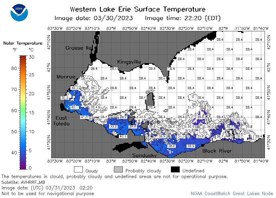 | e1_2023_03_31_0220.png | 31-Mar-2023 05:28 | 38709 | |
 | e1_2023_03_31_0320.png | 31-Mar-2023 06:26 | 29293 | |
 | e1_2023_03_31_0620.png | 31-Mar-2023 10:25 | 24822 | |
 | e1_2023_03_31_0710.png | 31-Mar-2023 11:27 | 23047 | |
 | e1_2023_03_31_0800.png | 31-Mar-2023 10:27 | 23002 | |
 | e1_2023_03_31_1440.png | 31-Mar-2023 17:26 | 22930 | |
 | e1_2023_03_31_1530.png | 31-Mar-2023 19:26 | 22995 | |
 | e1_2023_03_31_1620.png | 31-Mar-2023 19:28 | 23012 | |
 | e1_2023_03_31_1740.png | 31-Mar-2023 20:26 | 28944 | |
 | e1_2023_03_31_1830.png | 31-Mar-2023 22:26 | 35878 | |
 | e1_2023_03_31_1920.png | 31-Mar-2023 22:28 | 34339 | |
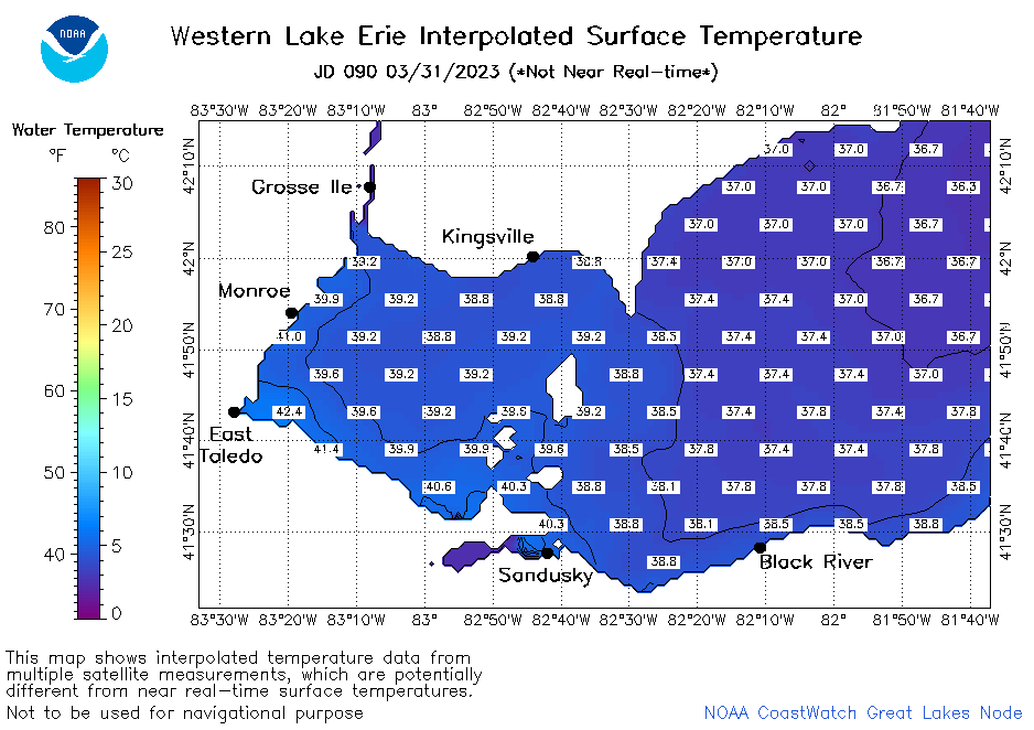 | e1_2023_090.png | 01-Apr-2023 09:15 | 28025 | |