
Easier access to scientific data

Brought to you by NOAA CoastWatch Great Lakes Node
|
ERDDAP
Easier access to scientific data |
|
Brought to you by NOAA CoastWatch Great Lakes Node |
| Dataset Title: | Lake Erie Western Region Surface Temperature Contour Map (2022-present)


|
| Institution: | CoastWatch Great Lakes Node (Dataset ID: LE_NRT_TC_e1) |
| Information: | Summary
| License
| Metadata
| Background | Subset
| Data Access Form
| Make a graph
| Subset
| Data Access Form
| Make a graph
|
![[ICO]](https://apps.glerl.noaa.gov/erddap/images/fileIcons/blank.gif) | Name | Last modified | Size | Description |
|---|---|---|---|---|
![[DIR]](https://apps.glerl.noaa.gov/erddap/images/fileIcons/back.gif) | Parent Directory | - | - | |
![[IMG]](https://apps.glerl.noaa.gov/erddap/images/fileIcons/image2.gif)  | e1_2023_03_21_0140.png | 22-Mar-2023 19:29 | 30467 | |
 | e1_2023_03_21_0230.png | 22-Mar-2023 19:33 | 47205 | |
 | e1_2023_03_21_0320.png | 22-Mar-2023 19:35 | 33179 | |
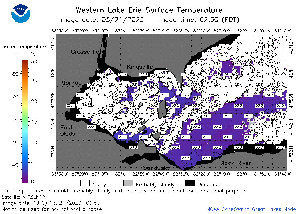 | e1_2023_03_21_0650.png | 22-Mar-2023 19:41 | 45331 | |
 | e1_2023_03_21_0740.png | 22-Mar-2023 19:45 | 47672 | |
 | e1_2023_03_21_0830.png | 22-Mar-2023 19:48 | 51042 | |
 | e1_2023_03_21_1450.png | 22-Mar-2023 19:56 | 36605 | |
 | e1_2023_03_21_1540.png | 22-Mar-2023 19:58 | 42197 | |
 | e1_2023_03_21_1630.png | 22-Mar-2023 20:00 | 29146 | |
 | e1_2023_03_21_1730.png | 22-Mar-2023 20:04 | 33630 | |
 | e1_2023_03_21_1820.png | 22-Mar-2023 20:06 | 25345 | |
 | e1_2023_03_21_1910.png | 22-Mar-2023 20:09 | 23108 | |
 | e1_2023_080.png | 22-Mar-2023 09:15 | 29155 | |