
Easier access to scientific data

Brought to you by NOAA CoastWatch Great Lakes Node
|
ERDDAP
Easier access to scientific data |
|
Brought to you by NOAA CoastWatch Great Lakes Node |
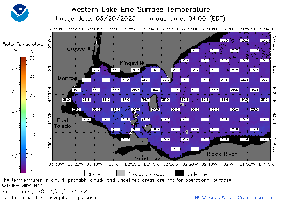
| Dataset Title: | Lake Erie Western Region Surface Temperature Contour Map (2022-present)


|
| Institution: | CoastWatch Great Lakes Node (Dataset ID: LE_NRT_TC_e1) |
| Information: | Summary
| License
| Metadata
| Background | Subset
| Data Access Form
| Make a graph
| Subset
| Data Access Form
| Make a graph
|
![[ICO]](https://apps.glerl.noaa.gov/erddap/images/fileIcons/blank.gif) | Name | Last modified | Size | Description |
|---|---|---|---|---|
![[DIR]](https://apps.glerl.noaa.gov/erddap/images/fileIcons/back.gif) | Parent Directory | - | - | |
![[IMG]](https://apps.glerl.noaa.gov/erddap/images/fileIcons/image2.gif)  | e1_2023_03_20_0110.png | 22-Mar-2023 18:39 | 37568 | |
 | e1_2023_03_20_0200.png | 22-Mar-2023 18:41 | 43082 | |
 | e1_2023_03_20_0250.png | 22-Mar-2023 18:45 | 51664 | |
 | e1_2023_03_20_0620.png | 22-Mar-2023 18:51 | 46845 | |
 | e1_2023_03_20_0710.png | 22-Mar-2023 18:54 | 42563 | |
 | e1_2023_03_20_0800.png | 22-Mar-2023 18:56 | 38614 | |
 | e1_2023_03_20_1420.png | 22-Mar-2023 19:02 | 31755 | |
 | e1_2023_03_20_1510.png | 22-Mar-2023 19:04 | 36631 | |
 | e1_2023_03_20_1600.png | 22-Mar-2023 19:06 | 33844 | |
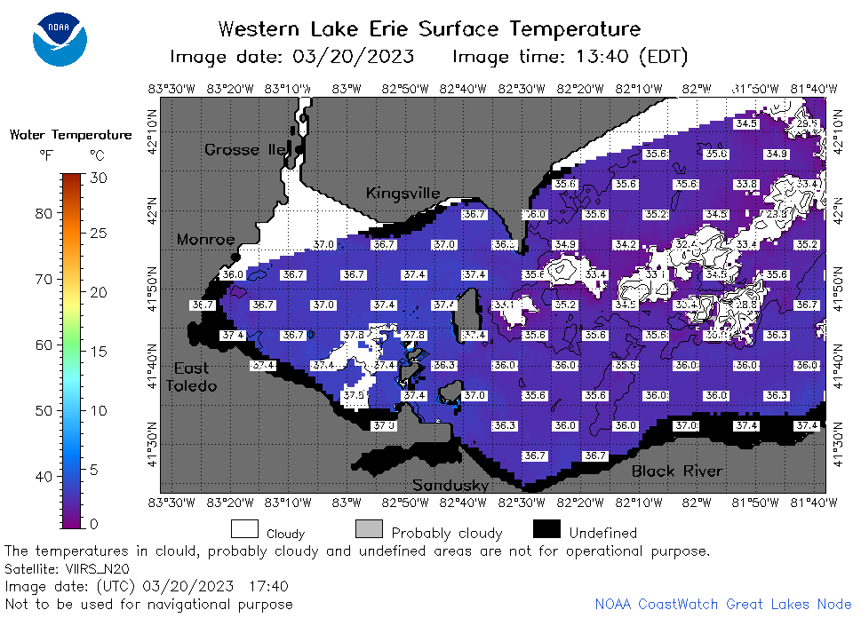 | e1_2023_03_20_1740.png | 22-Mar-2023 19:14 | 41303 | |
 | e1_2023_03_20_1750.png | 22-Mar-2023 19:17 | 22097 | |
 | e1_2023_03_20_1840.png | 22-Mar-2023 19:19 | 43127 | |
 | e1_2023_03_20_1930.png | 22-Mar-2023 19:21 | 39642 | |
 | e1_2023_079.png | 21-Mar-2023 09:15 | 27669 | |