
Easier access to scientific data

Brought to you by NOAA CoastWatch Great Lakes Node
|
ERDDAP
Easier access to scientific data |
|
Brought to you by NOAA CoastWatch Great Lakes Node |
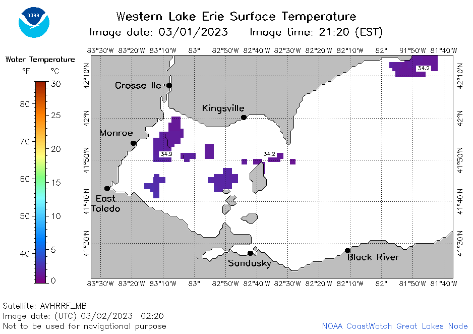
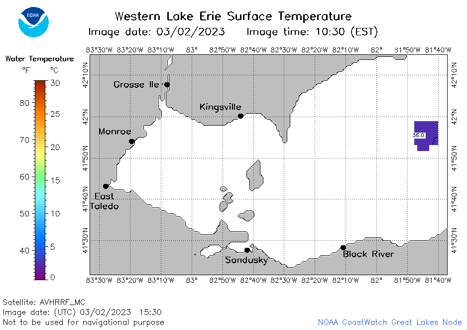
| Dataset Title: | Lake Erie Western Region Surface Temperature Contour Map (2022-present)


|
| Institution: | CoastWatch Great Lakes Node (Dataset ID: LE_NRT_TC_e1) |
| Information: | Summary
| License
| Metadata
| Background | Subset
| Data Access Form
| Make a graph
| Subset
| Data Access Form
| Make a graph
|
![[ICO]](https://apps.glerl.noaa.gov/erddap/images/fileIcons/blank.gif) | Name | Last modified | Size | Description |
|---|---|---|---|---|
![[DIR]](https://apps.glerl.noaa.gov/erddap/images/fileIcons/back.gif) | Parent Directory | - | - | |
![[IMG]](https://apps.glerl.noaa.gov/erddap/images/fileIcons/image2.gif)  | e1_2023_03_02_0140.png | 02-Mar-2023 06:24 | 19748 | |
 | e1_2023_03_02_0220.png | 02-Mar-2023 06:25 | 20039 | |
 | e1_2023_03_02_0700.png | 02-Mar-2023 10:25 | 20317 | |
 | e1_2023_03_02_0750.png | 02-Mar-2023 11:24 | 25379 | |
 | e1_2023_03_02_0840.png | 02-Mar-2023 17:24 | 20927 | |
 | e1_2023_03_02_1440.png | 02-Mar-2023 17:25 | 20629 | |
 | e1_2023_03_02_1530.png | 02-Mar-2023 19:24 | 19330 | |
 | e1_2023_03_02_1820.png | 02-Mar-2023 21:26 | 19284 | |
 | e1_2023_03_02_1910.png | 02-Mar-2023 22:25 | 19343 | |
 | e1_2023_061.png | 03-Mar-2023 10:15 | 31338 | |