
Easier access to scientific data

Brought to you by NOAA CoastWatch Great Lakes Node
|
ERDDAP
Easier access to scientific data |
|
Brought to you by NOAA CoastWatch Great Lakes Node |
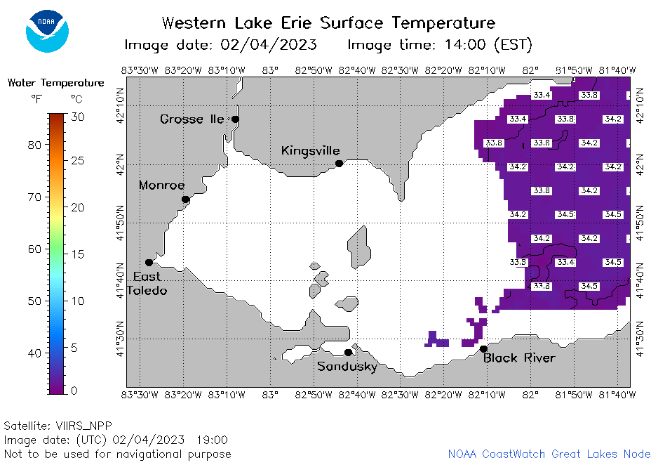
| Dataset Title: | Lake Erie Western Region Surface Temperature Contour Map (2022-present)


|
| Institution: | CoastWatch Great Lakes Node (Dataset ID: LE_NRT_TC_e1) |
| Information: | Summary
| License
| Metadata
| Background | Subset
| Data Access Form
| Make a graph
| Subset
| Data Access Form
| Make a graph
|
![[ICO]](https://apps.glerl.noaa.gov/erddap/images/fileIcons/blank.gif) | Name | Last modified | Size | Description |
|---|---|---|---|---|
![[DIR]](https://apps.glerl.noaa.gov/erddap/images/fileIcons/back.gif) | Parent Directory | - | - | |
![[IMG]](https://apps.glerl.noaa.gov/erddap/images/fileIcons/image2.gif)  | e1_2023_02_04_0120.png | 04-Feb-2023 06:24 | 19544 | |
 | e1_2023_02_04_0210.png | 04-Feb-2023 06:25 | 19806 | |
 | e1_2023_02_04_0300.png | 04-Feb-2023 06:26 | 19230 | |
 | e1_2023_02_04_1430.png | 04-Feb-2023 18:24 | 19560 | |
 | e1_2023_02_04_1610.png | 04-Feb-2023 20:24 | 19479 | |
 | e1_2023_02_04_1720.png | 04-Feb-2023 20:26 | 22021 | |
 | e1_2023_02_04_1810.png | 04-Feb-2023 21:24 | 22201 | |
 | e1_2023_02_04_1900.png | 04-Feb-2023 21:25 | 22382 | |
 | e1_2023_035.png | 05-Feb-2023 10:16 | 32146 | |