
Easier access to scientific data

Brought to you by NOAA CoastWatch Great Lakes Node
|
ERDDAP
Easier access to scientific data |
|
Brought to you by NOAA CoastWatch Great Lakes Node |
| Dataset Title: | Lake Erie Western Region Surface Temperature Contour Map (2022-present)


|
| Institution: | CoastWatch Great Lakes Node (Dataset ID: LE_NRT_TC_e1) |
| Information: | Summary
| License
| Metadata
| Background | Subset
| Data Access Form
| Make a graph
| Subset
| Data Access Form
| Make a graph
|
![[ICO]](https://apps.glerl.noaa.gov/erddap/images/fileIcons/blank.gif) | Name | Last modified | Size | Description |
|---|---|---|---|---|
![[DIR]](https://apps.glerl.noaa.gov/erddap/images/fileIcons/back.gif) | Parent Directory | - | - | |
![[IMG]](https://apps.glerl.noaa.gov/erddap/images/fileIcons/image2.gif)  | e1_2023_01_31_0620.png | 31-Jan-2023 09:24 | 21006 | |
 | e1_2023_01_31_0710.png | 31-Jan-2023 11:24 | 21342 | |
 | e1_2023_01_31_0800.png | 31-Jan-2023 10:24 | 22076 | |
 | e1_2023_01_31_1500.png | 31-Jan-2023 18:25 | 21120 | |
 | e1_2023_01_31_1550.png | 31-Jan-2023 19:24 | 21189 | |
 | e1_2023_01_31_1640.png | 31-Jan-2023 19:25 | 19646 | |
 | e1_2023_01_31_1740.png | 31-Jan-2023 21:25 | 21462 | |
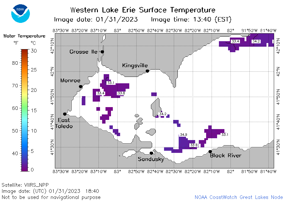 | e1_2023_01_31_1840.png | 31-Jan-2023 21:26 | 20857 | |
 | e1_2023_01_31_1930.png | 31-Jan-2023 21:27 | 21495 | |
 | e1_2023_031.png | 01-Feb-2023 10:16 | 33489 | |