
Easier access to scientific data

Brought to you by NOAA CoastWatch Great Lakes Node
|
ERDDAP
Easier access to scientific data |
|
Brought to you by NOAA CoastWatch Great Lakes Node |
| Dataset Title: | Lake Erie Western Region Surface Temperature Contour Map (2022-present)


|
| Institution: | CoastWatch Great Lakes Node (Dataset ID: LE_NRT_TC_e1) |
| Information: | Summary
| License
| Metadata
| Background | Subset
| Data Access Form
| Make a graph
| Subset
| Data Access Form
| Make a graph
|
![[ICO]](https://apps.glerl.noaa.gov/erddap/images/fileIcons/blank.gif) | Name | Last modified | Size | Description |
|---|---|---|---|---|
![[DIR]](https://apps.glerl.noaa.gov/erddap/images/fileIcons/back.gif) | Parent Directory | - | - | |
![[IMG]](https://apps.glerl.noaa.gov/erddap/images/fileIcons/image2.gif) 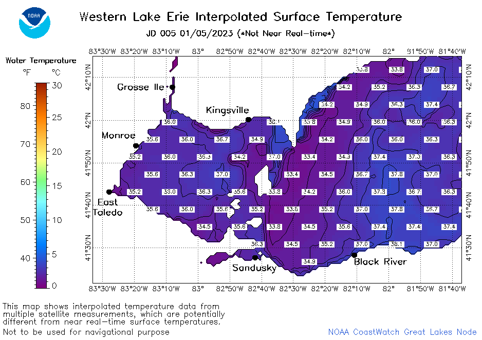 | e1_2023_005.png | 06-Jan-2023 10:15 | 35478 | |
 | e1_2023_01_05_0140.png | 05-Jan-2023 06:24 | 20815 | |
 | e1_2023_01_05_0230.png | 05-Jan-2023 06:25 | 20030 | |
 | e1_2023_01_05_0320.png | 05-Jan-2023 06:27 | 21524 | |
 | e1_2023_01_05_0610.png | 05-Jan-2023 09:24 | 21065 | |
 | e1_2023_01_05_0700.png | 05-Jan-2023 11:24 | 19104 | |
 | e1_2023_01_05_0750.png | 05-Jan-2023 10:24 | 19206 | |
 | e1_2023_01_05_0840.png | 05-Jan-2023 12:24 | 19340 | |
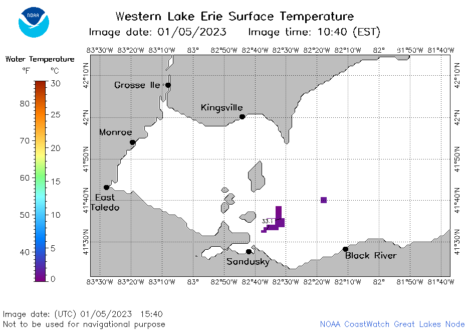 | e1_2023_01_05_1540.png | 05-Jan-2023 18:24 | 19254 | |
 | e1_2023_01_05_1630.png | 05-Jan-2023 20:24 | 20435 | |
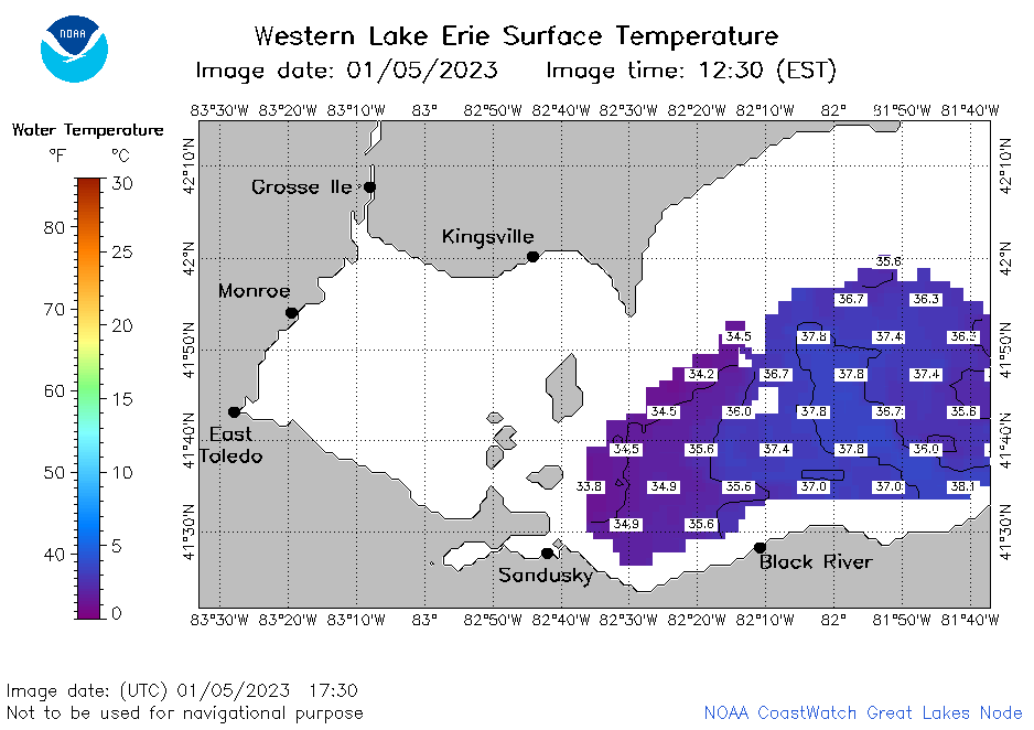 | e1_2023_01_05_1730.png | 05-Jan-2023 20:25 | 23367 | |
 | e1_2023_01_05_1820.png | 05-Jan-2023 21:24 | 21094 | |
 | e1_2023_01_05_1910.png | 05-Jan-2023 22:24 | 19057 | |